File:NPS glacier-bay-vegetation-map.jpg
Jump to navigation
Jump to search

Size of this preview: 800 × 522 pixels. Other resolutions: 320 × 209 pixels | 640 × 418 pixels | 1,024 × 669 pixels | 1,280 × 836 pixels | 2,560 × 1,671 pixels | 6,038 × 3,942 pixels.
Original file (6,038 × 3,942 pixels, file size: 3.8 MB, MIME type: image/jpeg)
Captions
Captions
Add a one-line explanation of what this file represents
Summary[edit]
| Description |
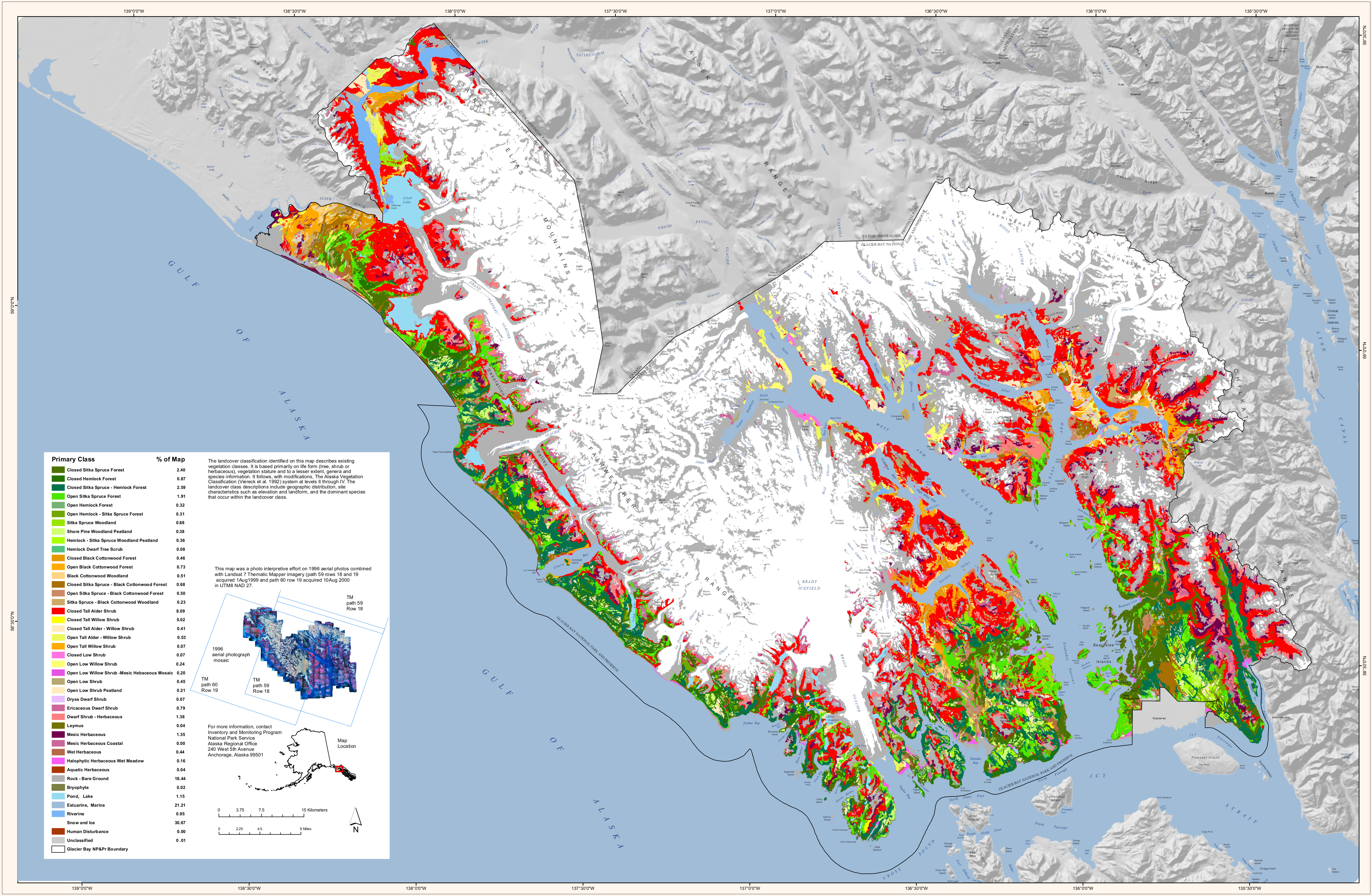
English: The Glacier Bay land cover map shows what you’ll find on the surface anywhere in Glacier Bay National Park – ice, rock, shrubs, forest, etc. This map labels what plant communities grow and where. |
| Date | |
| Source | U.S. National Park Service (http://npmaps.com/wp-content/uploads/glacier-bay-vegetation-map.jpg) |
| Author | U.S. National Park Service, restoration/cleanup by Matt Holly |
Licensing[edit]
| This image or media file contains material based on a work of a National Park Service employee, created as part of that person's official duties. As a work of the U.S. federal government, such work is in the public domain in the United States. See the NPS website and NPS copyright policy for more information. |
File history
Click on a date/time to view the file as it appeared at that time.
| Date/Time | Thumbnail | Dimensions | User | Comment | |
|---|---|---|---|---|---|
| current | 21:39, 16 May 2017 | | 6,038 × 3,942 (3.8 MB) | RKBot (talk | contribs) | =={{int:filedesc}}== {{Information |description= {{en|1=The Glacier Bay land cover map shows what you’ll find on the surface anywhere in Glacier Bay National Park – ice, rock, shrubs, forest, etc. This map labels what plant communities grow and whe... |
You cannot overwrite this file.
File usage on Commons
The following 2 pages use this file: