File:NPS glacier-bay-bartlett-cove-campground-map.jpg
Jump to navigation
Jump to search

Size of this preview: 800 × 465 pixels. Other resolutions: 320 × 186 pixels | 640 × 372 pixels | 1,024 × 596 pixels | 1,280 × 745 pixels | 2,484 × 1,445 pixels.
Original file (2,484 × 1,445 pixels, file size: 326 KB, MIME type: image/jpeg)
Captions
Captions
Add a one-line explanation of what this file represents
Summary[edit]
| Description |
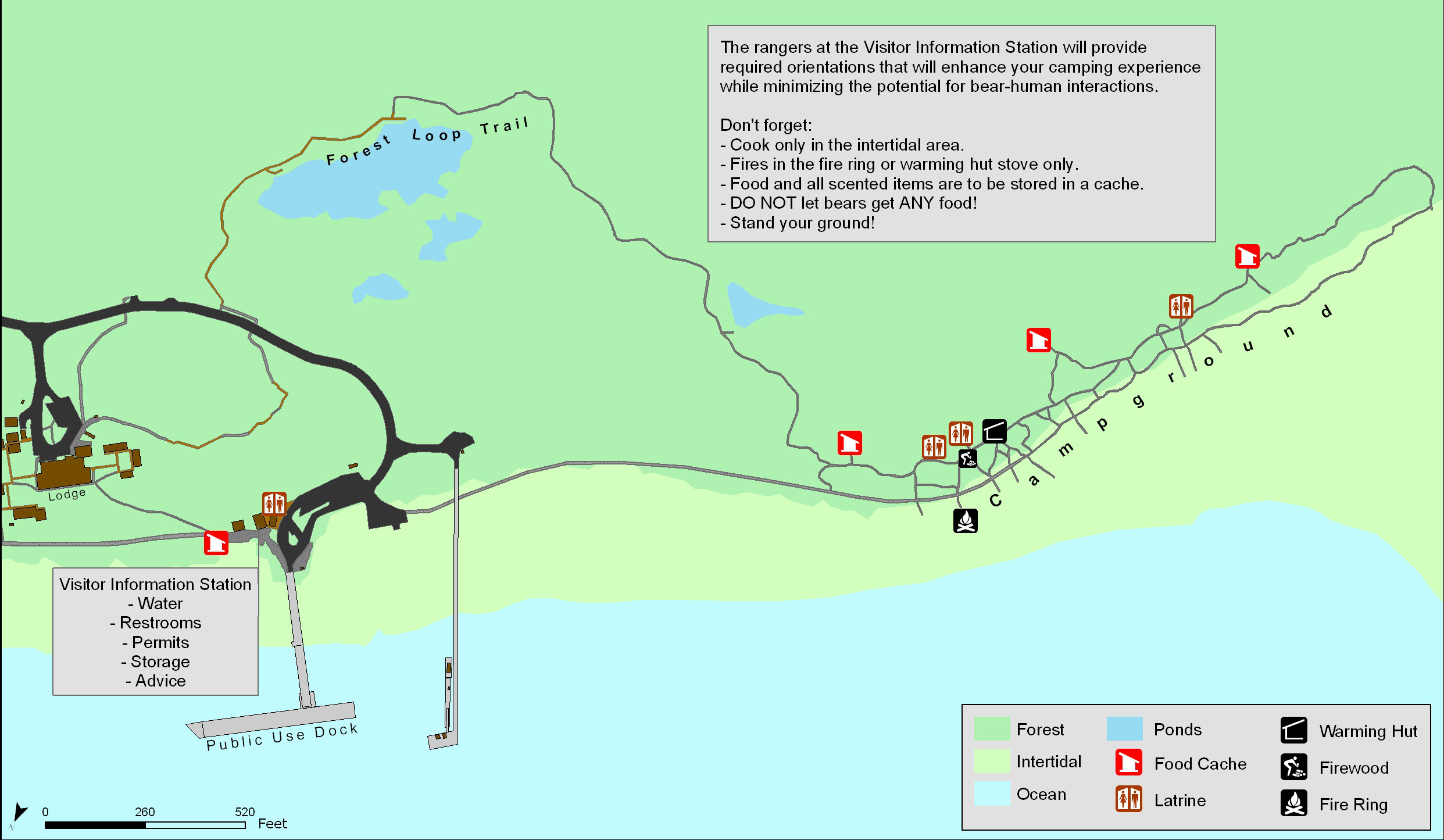
English: This Bartlett Cove campground map shows the park’s only campground, located near the visitor center and park headquarters. Here you see it in relation to the docks and visitor information station. |
| Date | |
| Source | U.S. National Park Service (http://npmaps.com/wp-content/uploads/glacier-bay-bartlett-cove-campground-map.jpg) |
| Author | U.S. National Park Service, restoration/cleanup by Matt Holly |
Licensing[edit]
| This image or media file contains material based on a work of a National Park Service employee, created as part of that person's official duties. As a work of the U.S. federal government, such work is in the public domain in the United States. See the NPS website and NPS copyright policy for more information. |
File history
Click on a date/time to view the file as it appeared at that time.
| Date/Time | Thumbnail | Dimensions | User | Comment | |
|---|---|---|---|---|---|
| current | 21:38, 16 May 2017 | | 2,484 × 1,445 (326 KB) | RKBot (talk | contribs) | =={{int:filedesc}}== {{Information |description= {{en|1=This Bartlett Cove campground map shows the park’s only campground, located near the visitor center and park headquarters. Here you see it in relation to the docks and visitor information statio... |
You cannot overwrite this file.
File usage on Commons
The following 3 pages use this file:
File usage on other wikis
The following other wikis use this file:
- Usage on www.wikidata.org