File:NPS canyonlands-vegetation-map.jpg
Jump to navigation
Jump to search

Size of this preview: 479 × 599 pixels. Other resolutions: 192 × 240 pixels | 384 × 480 pixels | 614 × 768 pixels | 818 × 1,024 pixels | 1,637 × 2,048 pixels | 3,860 × 4,829 pixels.
Original file (3,860 × 4,829 pixels, file size: 3.61 MB, MIME type: image/jpeg)
Captions
Captions
Add a one-line explanation of what this file represents
Summary[edit]
| Description |
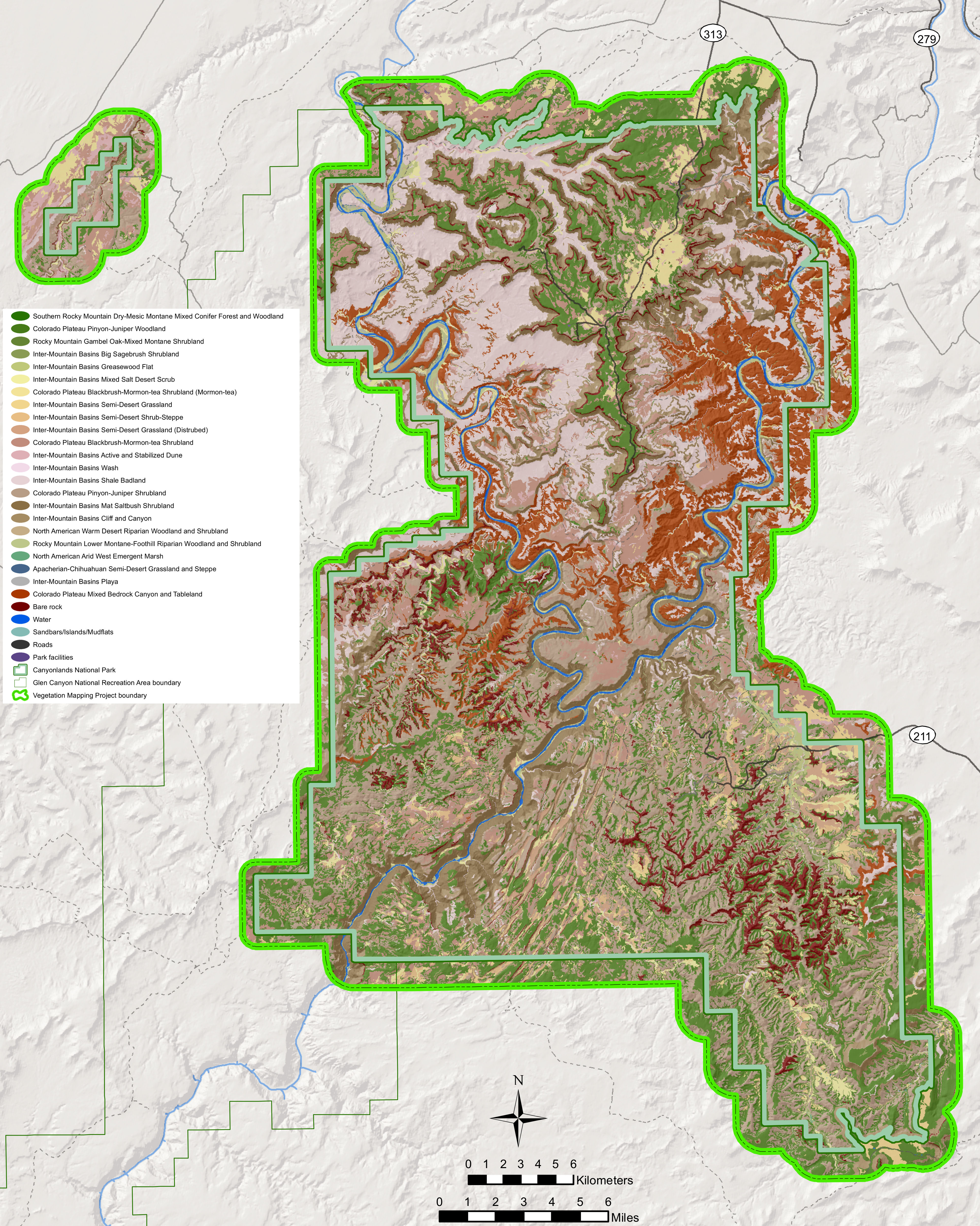
English: The Canyonlands vegetation map identifies the various types of vegetation communities within the park, as well as areas that are just bare rock. |
| Date | |
| Source | U.S. National Park Service (http://npmaps.com/wp-content/uploads/canyonlands-vegetation-map.jpg) |
| Author | U.S. National Park Service, restoration/cleanup by Matt Holly |
Licensing[edit]
| This image or media file contains material based on a work of a National Park Service employee, created as part of that person's official duties. As a work of the U.S. federal government, such work is in the public domain in the United States. See the NPS website and NPS copyright policy for more information. |
File history
Click on a date/time to view the file as it appeared at that time.
| Date/Time | Thumbnail | Dimensions | User | Comment | |
|---|---|---|---|---|---|
| current | 19:51, 16 May 2017 | | 3,860 × 4,829 (3.61 MB) | RKBot (talk | contribs) | =={{int:filedesc}}== {{Information |description= {{en|1=The Canyonlands vegetation map identifies the various types of vegetation communities within the park, as well as areas that are just bare rock.}} |date= 2017-01-24 |source= U.S. National Park Ser... |
You cannot overwrite this file.
File usage on Commons
There are no pages that use this file.