File:NPS black-canyon-south-rim-campground-map.gif
Jump to navigation
Jump to search

Size of this preview: 527 × 600 pixels. Other resolutions: 211 × 240 pixels | 422 × 480 pixels | 675 × 768 pixels | 900 × 1,024 pixels | 1,490 × 1,696 pixels.
Original file (1,490 × 1,696 pixels, file size: 179 KB, MIME type: image/gif, 0.1 s)
Captions
Captions
Add a one-line explanation of what this file represents
Summary
[edit]
| Description |
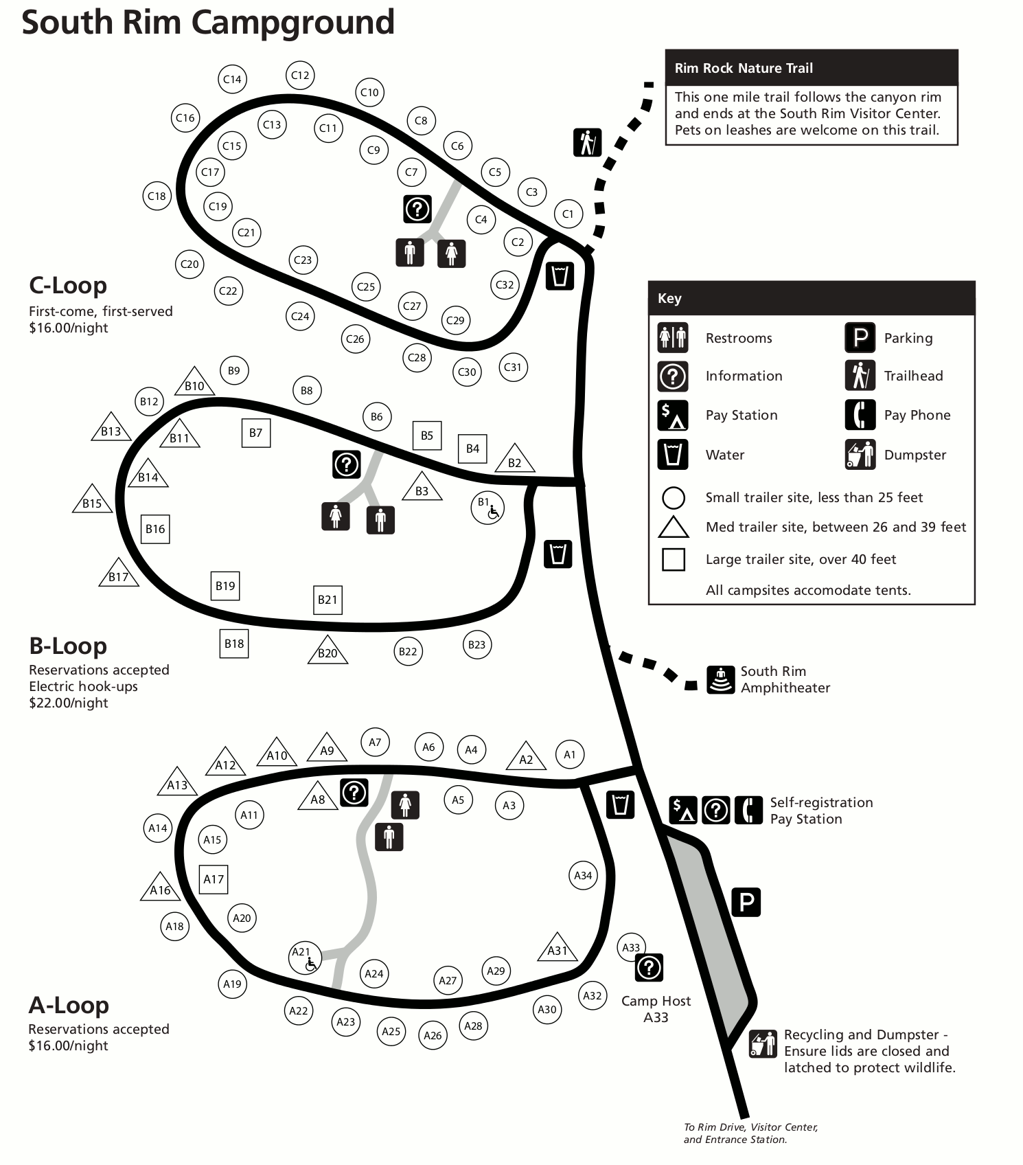
English: The South Rim Campground map shows the largest campground in the park, it includes three loops and has both campsites available for reservations and also first-come first-served ones. |
| Date | |
| Source | U.S. National Park Service (http://npmaps.com/wp-content/uploads/black-canyon-south-rim-campground-map.gif) |
| Author | U.S. National Park Service, restoration/cleanup by Matt Holly |
Licensing
[edit]
| This image or media file contains material based on a work of a National Park Service employee, created as part of that person's official duties. As a work of the U.S. federal government, such work is in the public domain in the United States. See the NPS website and NPS copyright policy for more information. |
File history
Click on a date/time to view the file as it appeared at that time.
| Date/Time | Thumbnail | Dimensions | User | Comment | |
|---|---|---|---|---|---|
| current | 16:33, 16 May 2017 | | 1,490 × 1,696 (179 KB) | RKBot (talk | contribs) | =={{int:filedesc}}== {{Information |description= {{en|1=The South Rim Campground map shows the largest campground in the park, it includes three loops and has both campsites available for reservations and also first-come first-served ones.}} |date= 201... |
You cannot overwrite this file.
File usage on Commons
The following 2 pages use this file:
File usage on other wikis
The following other wikis use this file:
- Usage on www.wikidata.org