File:NPS badlands-geologic-map-west.jpg
Jump to navigation
Jump to search
Size of this preview: 800 × 549 pixels. Other resolutions: 320 × 220 pixels | 640 × 440 pixels | 1,024 × 703 pixels | 1,280 × 879 pixels | 2,560 × 1,758 pixels | 3,320 × 2,280 pixels.
Original file (3,320 × 2,280 pixels, file size: 1.66 MB, MIME type: image/jpeg)
Captions
Captions
Add a one-line explanation of what this file represents
Summary
[edit]
| Description |
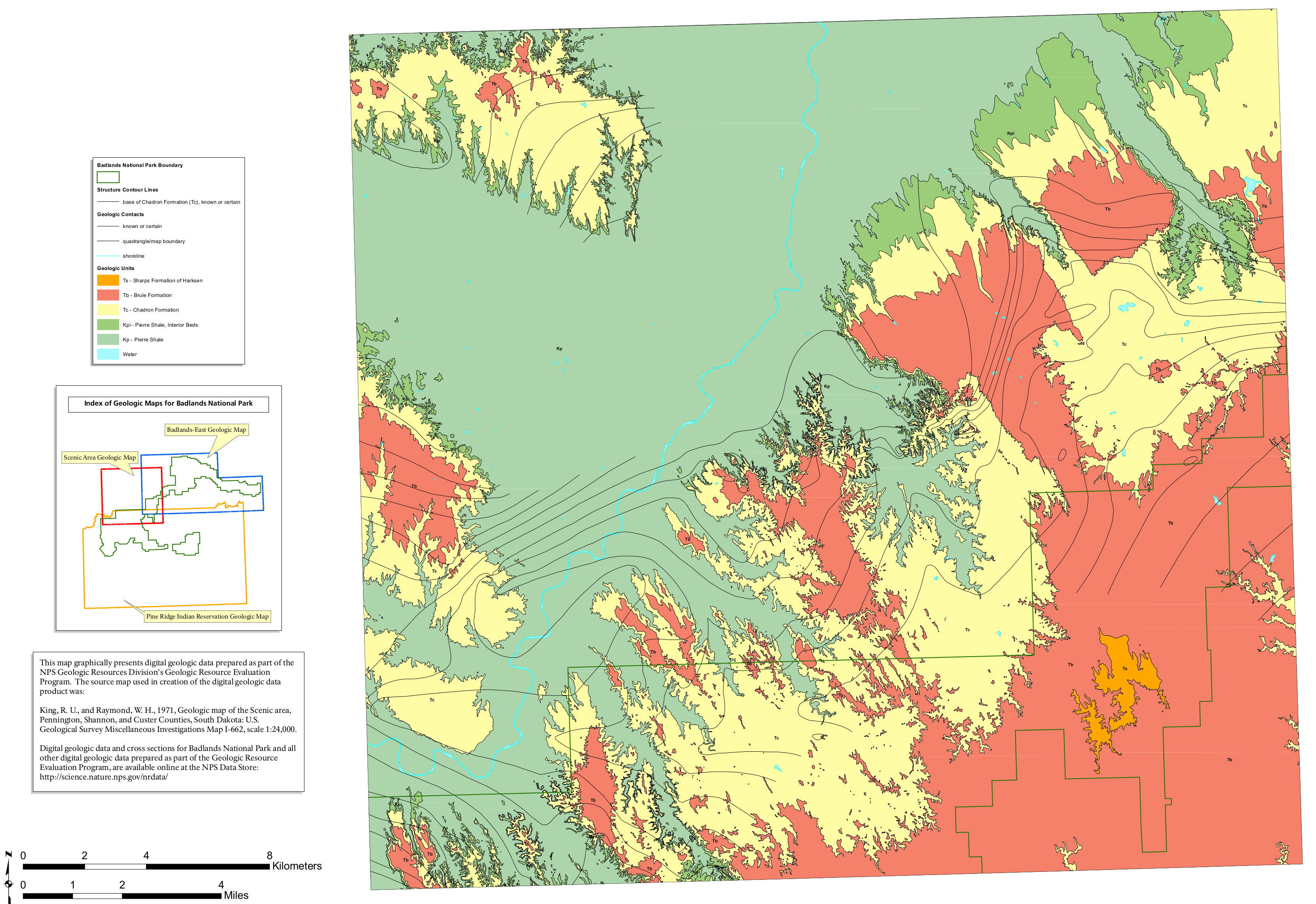
English: This Badlands west geologic map shows the area to the west of the previous map above, featuring tons and tons of Pierre Shale, which was originally deposited underwater. |
| Date | |
| Source | U.S. National Park Service (http://npmaps.com/wp-content/uploads/badlands-geologic-map-west.jpg) |
| Author | U.S. National Park Service, restoration/cleanup by Matt Holly |
Licensing
[edit]
| This image or media file contains material based on a work of a National Park Service employee, created as part of that person's official duties. As a work of the U.S. federal government, such work is in the public domain in the United States. See the NPS website and NPS copyright policy for more information. |
File history
Click on a date/time to view the file as it appeared at that time.
| Date/Time | Thumbnail | Dimensions | User | Comment | |
|---|---|---|---|---|---|
| current | 12:00, 16 May 2017 | | 3,320 × 2,280 (1.66 MB) | RKBot (talk | contribs) | =={{int:filedesc}}== {{Information |description= {{en|1=This Badlands west geologic map shows the area to the west of the previous map above, featuring tons and tons of Pierre Shale, which was originally deposited underwater.}} |date= 2017-01-17 |sourc... |
You cannot overwrite this file.
File usage on Commons
The following page uses this file:
Categories:
- Geological maps of Badlands National Park
- Geological maps of South Dakota
- Pierre Shale - maps
- Geologic formations in Badlands National Park
- Maps of the White River Group (geology)
- Chadron Formation in Badlands National Park
- White River Group in Badlands National Park
- Chadron Formation - maps
- Pierre Shale in South Dakota