File:NPS arches-devils-garden-map.gif
Jump to navigation
Jump to search

Size of this preview: 799 × 252 pixels. Other resolutions: 320 × 101 pixels | 640 × 202 pixels | 2,416 × 762 pixels.
Original file (2,416 × 762 pixels, file size: 132 KB, MIME type: image/gif, 0.1 s)
Captions
Captions
Add a one-line explanation of what this file represents
Summary
[edit]
| Description |
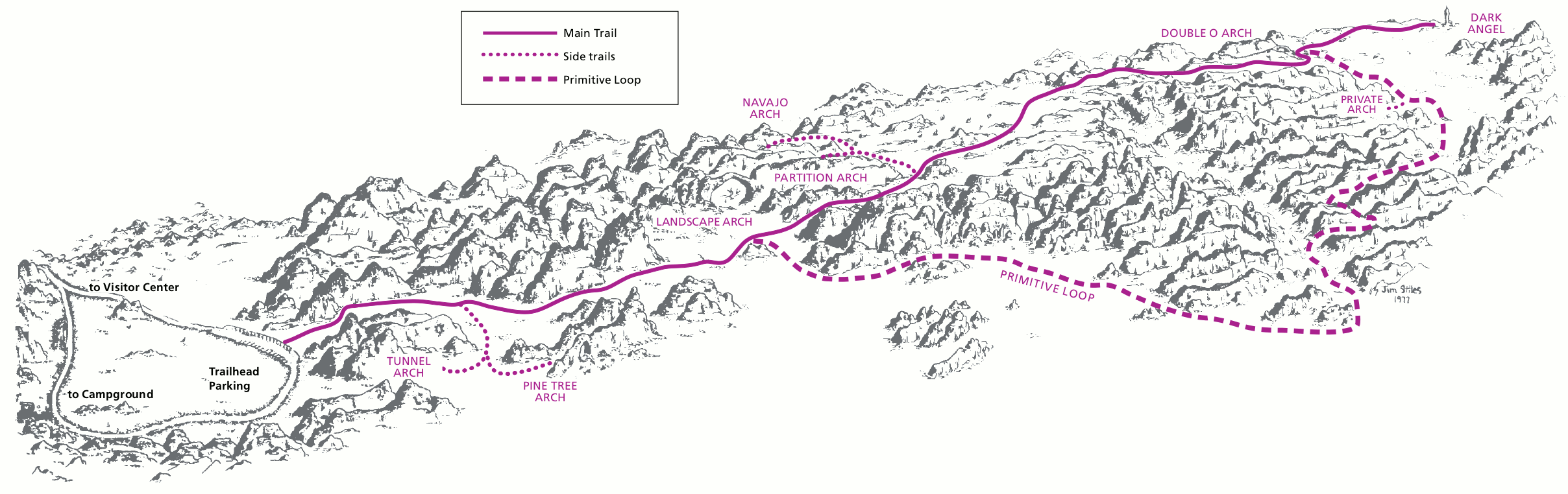
English: Devils Garden Trail hiking map, showing the main trail to Landscape Arch, Partition Arch, and other rock formations. Hike it one way to Double O Arch or do the whole loop if it’s not too hot. |
| Date | |
| Source | U.S. National Park Service (http://npmaps.com/wp-content/uploads/arches-devils-garden-map.gif) |
| Author | U.S. National Park Service, restoration/cleanup by Matt Holly |
| Other versions |
 |
Licensing
[edit]
| This image or media file contains material based on a work of a National Park Service employee, created as part of that person's official duties. As a work of the U.S. federal government, such work is in the public domain in the United States. See the NPS website and NPS copyright policy for more information. |
File history
Click on a date/time to view the file as it appeared at that time.
| Date/Time | Thumbnail | Dimensions | User | Comment | |
|---|---|---|---|---|---|
| current | 18:39, 13 May 2017 | 2,416 × 762 (132 KB) | RKBot (talk | contribs) | =={{int:filedesc}}== {{Information |description= {{en|1=Devils Garden Trail hiking map, showing the main trail to Landscape Arch, Partition Arch, and other rock formations. Hike it one way to Double O Arch or do the whole loop if it’s not too hot.}}... |
You cannot overwrite this file.
File usage on Commons
The following 2 pages use this file: