File:NPS apostle-islands-surficial-geologic-map.jpg
Jump to navigation
Jump to search

Size of this preview: 395 × 599 pixels. Other resolutions: 158 × 240 pixels | 316 × 480 pixels | 506 × 768 pixels | 675 × 1,024 pixels | 1,351 × 2,048 pixels | 2,794 × 4,236 pixels.
Original file (2,794 × 4,236 pixels, file size: 1.45 MB, MIME type: image/jpeg)
Captions
Captions
Add a one-line explanation of what this file represents
Summary[edit]
| Description |
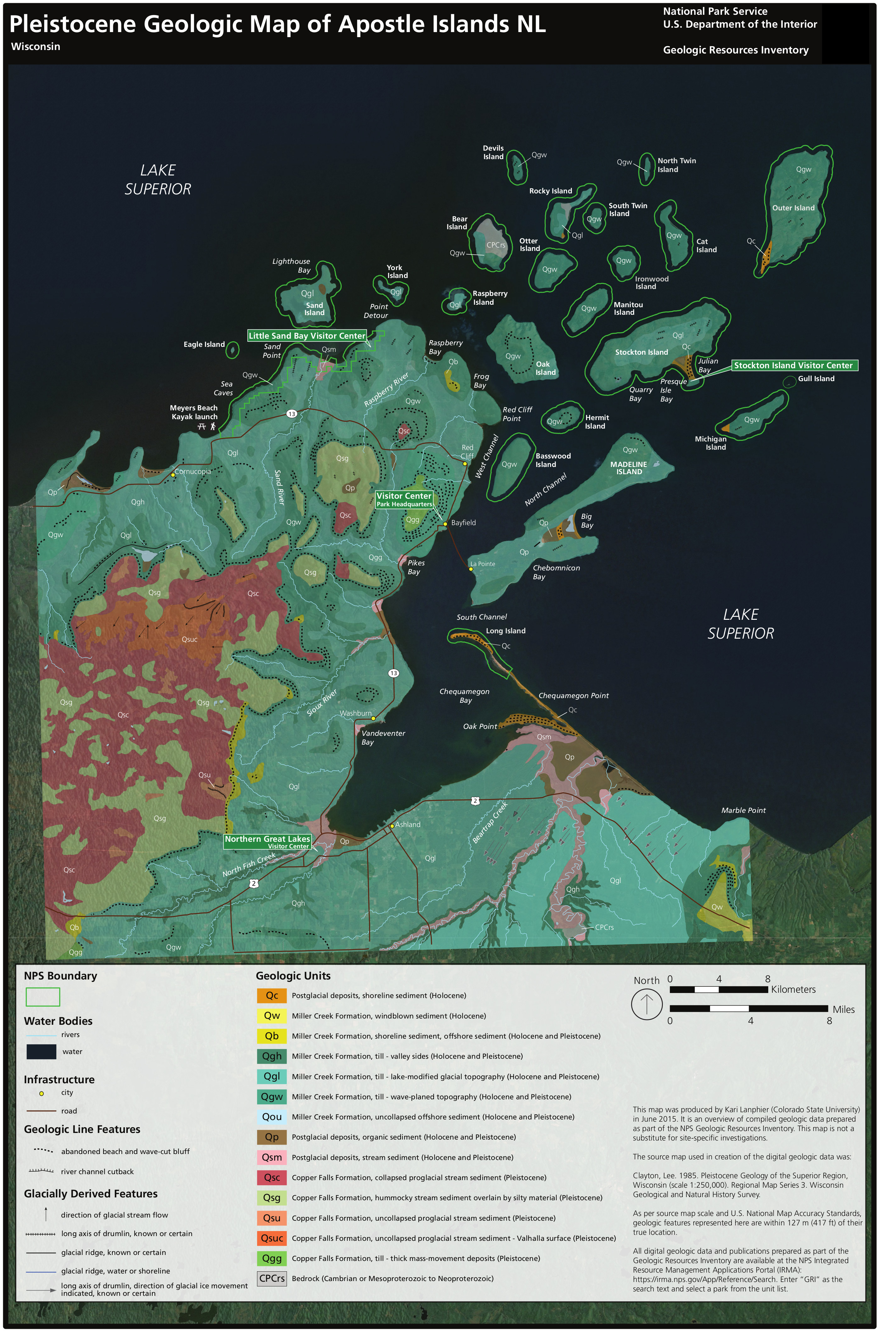
English: The Apostle Islands surficial geologic map focuses on the glacial deposits and more recently-formed landforms exposed at the park’s surface, shaped by wind and waves. |
| Date | |
| Source | U.S. National Park Service (http://npmaps.com/wp-content/uploads/apostle-islands-surficial-geologic-map.jpg) |
| Author | U.S. National Park Service, restoration/cleanup by Matt Holly |
Licensing[edit]
| This image or media file contains material based on a work of a National Park Service employee, created as part of that person's official duties. As a work of the U.S. federal government, such work is in the public domain in the United States. See the NPS website and NPS copyright policy for more information. |
File history
Click on a date/time to view the file as it appeared at that time.
| Date/Time | Thumbnail | Dimensions | User | Comment | |
|---|---|---|---|---|---|
| current | 18:37, 13 May 2017 | | 2,794 × 4,236 (1.45 MB) | RKBot (talk | contribs) | =={{int:filedesc}}== {{Information |description= {{en|1=The Apostle Islands surficial geologic map focuses on the glacial deposits and more recently-formed landforms exposed at the park’s surface, shaped by wind and waves.}} |date= 2017-01-08 |source... |
You cannot overwrite this file.
File usage on Commons
The following page uses this file:
Categories:
- Maps of Apostle Islands National Lakeshore
- Geological maps of Wisconsin
- Holocene lacustrine deposits in Wisconsin
- Miller Creek Formation
- Pleistocene organic deposits in Wisconsin
- Holocene organic deposits in Wisconsin
- Pleistocene fluvial deposits in Wisconsin
- Holocene fluvial deposits in Wisconsin
- Copper Falls Formation
- Cambrian bedrock in Wisconsin
- Precambrian bedrock in Wisconsin
- Quaternary geology of Wisconsin
- Surface geology of the United States