File:NPS american-samoa-geologic-map.jpg
Jump to navigation
Jump to search

Size of this preview: 800 × 523 pixels. Other resolutions: 320 × 209 pixels | 640 × 419 pixels | 1,024 × 670 pixels | 1,280 × 838 pixels | 2,560 × 1,675 pixels | 3,402 × 2,226 pixels.
Original file (3,402 × 2,226 pixels, file size: 1,002 KB, MIME type: image/jpeg)
Captions
Captions
Add a one-line explanation of what this file represents
Summary[edit]
| Description |
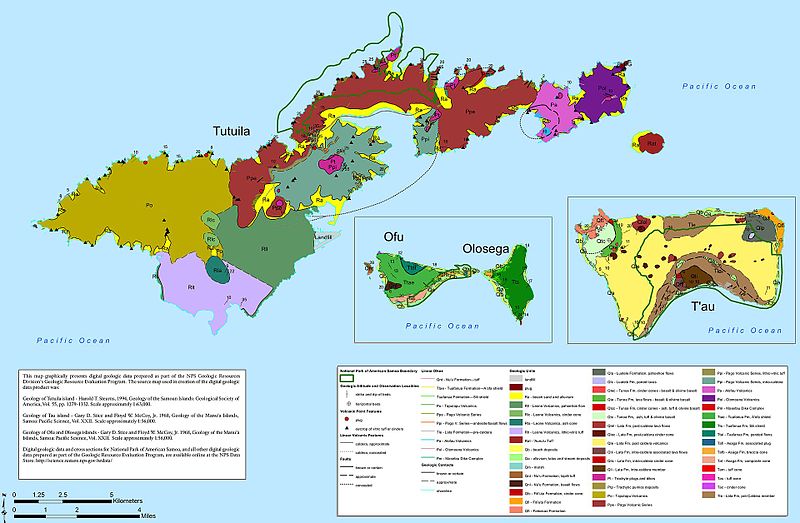
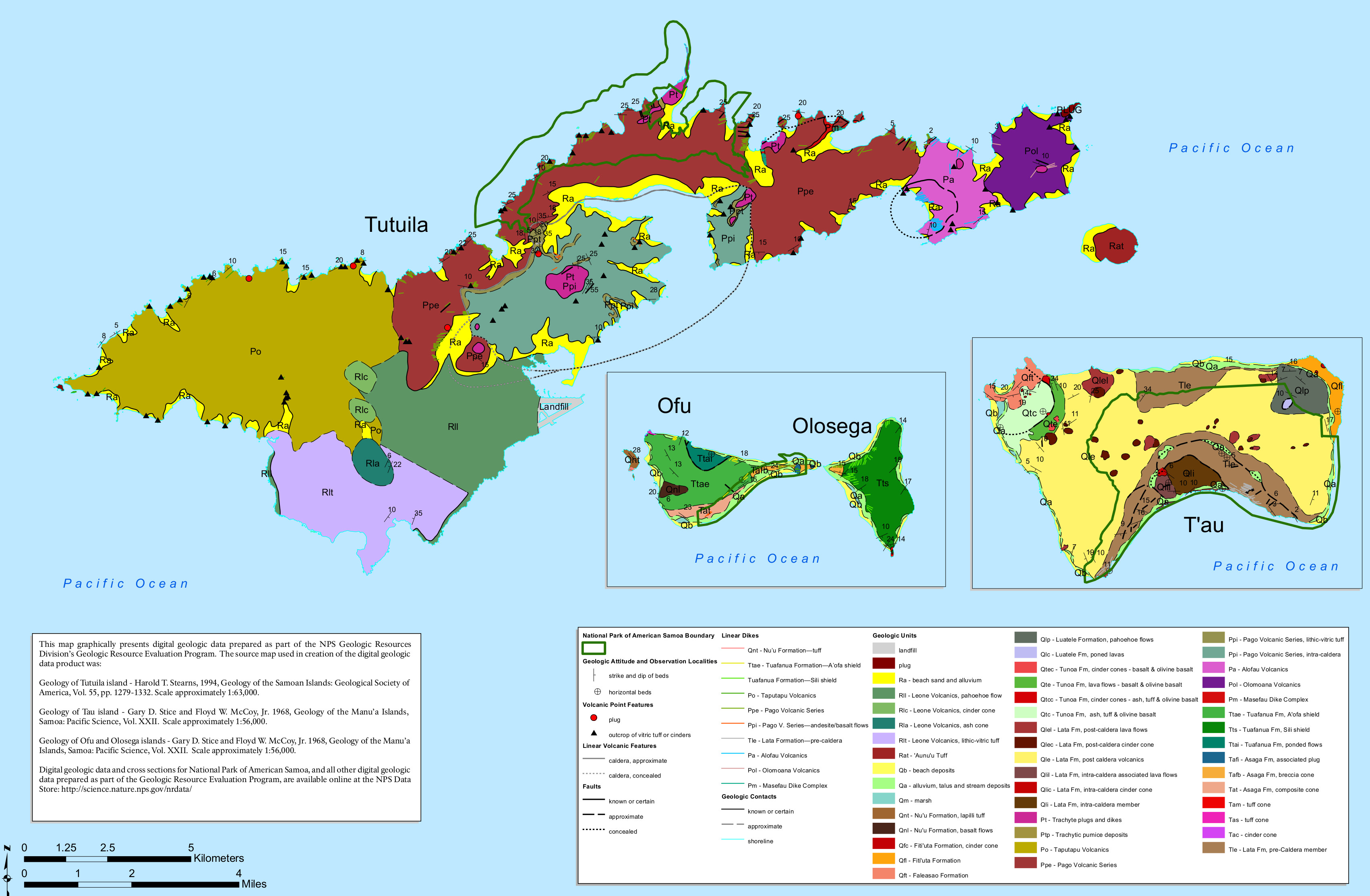
English: The American Samoa geologic map shows the bedrock geology of the lands both inside and outside the National Park of American Samoa on all three of islands that have park lands. |
| Date | |
| Source | U.S. National Park Service (http://npmaps.com/wp-content/uploads/american-samoa-geologic-map.jpg) |
| Author | U.S. National Park Service, restoration/cleanup by Matt Holly |
Licensing[edit]
| This image or media file contains material based on a work of a National Park Service employee, created as part of that person's official duties. As a work of the U.S. federal government, such work is in the public domain in the United States. See the NPS website and NPS copyright policy for more information. |
File history
Click on a date/time to view the file as it appeared at that time.
| Date/Time | Thumbnail | Dimensions | User | Comment | |
|---|---|---|---|---|---|
| current | 18:36, 13 May 2017 | | 3,402 × 2,226 (1,002 KB) | RKBot (talk | contribs) | =={{int:filedesc}}== {{Information |description= {{en|1=The American Samoa geologic map shows the bedrock geology of the lands both inside and outside the National Park of American Samoa on all three of islands that have park lands.}} |date= 2017-01-09... |
You cannot overwrite this file.
File usage on Commons
The following page uses this file: