File:NOAA Ocean Explorer Bermuda Geologic Map.png
Jump to navigation
Jump to search
No higher resolution available.
NOAA_Ocean_Explorer_Bermuda_Geologic_Map.png (654 × 500 pixels, file size: 187 KB, MIME type: image/png)
Captions
Captions
Add a one-line explanation of what this file represents
Summary[edit]
| Description |
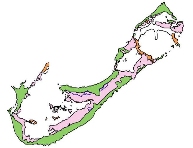
English: NOAA Ocean Explorer Bermuda Geologic Map. where orange denotes the Walsingham Formation, purple denotes the Town Hill and Belmont Formations, green denotes the Rocky Bay and Southhampton Formations, and white is fill associated with the airport |
| Date | |
| Source | NOAA Ocean Explorer, Origin of Bermuda and Its Caves |
| Author | US Dept. of Commerce |
Licensing[edit]
This image is in the public domain because it contains materials that originally came from the U.S. National Oceanic and Atmospheric Administration, taken or made as part of an employee's official duties.
|
File history
Click on a date/time to view the file as it appeared at that time.
| Date/Time | Thumbnail | Dimensions | User | Comment | |
|---|---|---|---|---|---|
| current | 15:25, 29 November 2017 | | 654 × 500 (187 KB) | Pi3.124 (talk | contribs) | User created page with UploadWizard |
You cannot overwrite this file.
File usage on Commons
There are no pages that use this file.
File usage on other wikis
The following other wikis use this file: