File:Mountain rockcress, Arabis eschscholtziana (40389826602).jpg

Original file (3,648 × 2,736 pixels, file size: 6.32 MB, MIME type: image/jpeg)
Captions
Captions
Summary[edit]
.jpg&action=edit§ion=1)
| Description |
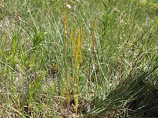
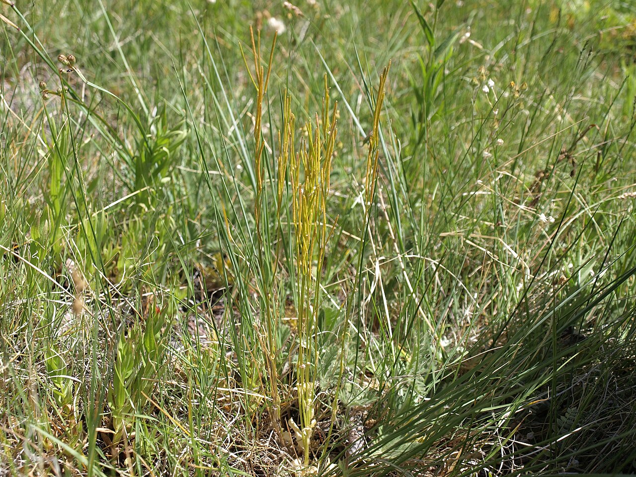
mountain rockcress, Arabis eschscholtziana, California, White Mountains, Cottonwood Basin, Fishlake Valley drainage, elevation 3021 m (9910 ft). One has to get out much earlier than I did to find this mustard in flower. This species, formerly known as Arabis hirsuta var. glabrata, is widespread in northwestern North America, from Alaska and northwestern Canada south to the northern Rocky Mountains, Great Basin, and into Southern California. This location in the White Mountains is about the highest elevation it reaches. It likes mesic sites such as meadows, swales, and rock crevices. For those following rockcress taxonomy, this is one of a handful of North American species that remain in the largely Eurasian genus Arabis after separation of the North American genus Boechera. Also visible in this image are meadow paintbrush (Castilleja miniata) and Idaho blue eyed grass (Sisyrinchium idahoense). |
| Date | |
| Source | mountain rockcress, Arabis eschscholtziana |
| Author | Jim Morefield from Nevada, USA |
| Camera location | | View this and other nearby images on: OpenStreetMap |
|---|
.jpg¶ms=037.551219_N_-118.174039_E_globe:Earth_type:camera_source:Flickr_&language=en)
Licensing[edit]
.jpg&action=edit§ion=2)
- You are free:
- to share – to copy, distribute and transmit the work
- to remix – to adapt the work
- Under the following conditions:
- attribution – You must give appropriate credit, provide a link to the license, and indicate if changes were made. You may do so in any reasonable manner, but not in any way that suggests the licensor endorses you or your use.
- share alike – If you remix, transform, or build upon the material, you must distribute your contributions under the same or compatible license as the original.
| This image was originally posted to Flickr by Jim Morefield at https://flickr.com/photos/127605180@N04/40389826602 (archive). It was reviewed on 29 December 2019 by FlickreviewR 2 and was confirmed to be licensed under the terms of the cc-by-sa-2.0. |
File history
Click on a date/time to view the file as it appeared at that time.
| Date/Time | Thumbnail | Dimensions | User | Comment | |
|---|---|---|---|---|---|
| current | 03:28, 29 December 2019 | | 3,648 × 2,736 (6.32 MB) | Ser Amantio di Nicolao (talk | contribs) | Transferred from Flickr via #flickr2commons |
You cannot overwrite this file.
File usage on Commons
The following page uses this file:
File usage on other wikis
The following other wikis use this file:
- Usage on ceb.wikipedia.org
- Usage on species.wikimedia.org
- Usage on sv.wikipedia.org
- Usage on www.wikidata.org
.jpg&oldid=601302008)