File:Morus rubra range.png
Jump to navigation
Jump to search
No higher resolution available.
Morus_rubra_range.png (693 × 593 pixels, file size: 113 KB, MIME type: image/png)
Captions
Captions
Add a one-line explanation of what this file represents
Summary[edit]
| Description |
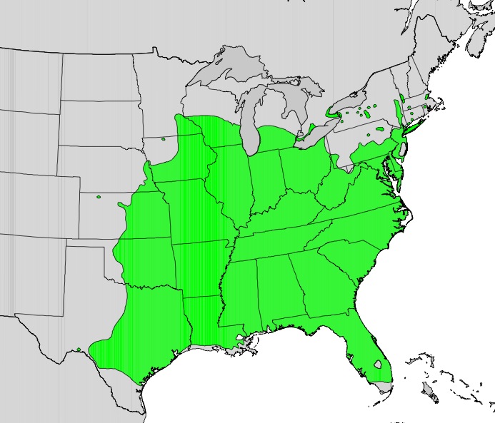
English: Range map of Morus rubra. |
| Date | |
| Source | Digital representation of "Atlas of United States Trees" by Elbert L. Little, Jr. [1] |
| Author | U.S. Geological Survey |
Licensing[edit]
This image is in the public domain in the United States because it only contains materials that originally came from the United States Geological Survey, an agency of the United States Department of the Interior. For more information, see the official USGS copyright policy.
|
Original upload log[edit]
Transferred from en.wikipedia to Commons by Pinethicket using CommonsHelper.
The original description page was here. All following user names refer to en.wikipedia.
- 2010-05-12 05:01 Masebrock 693×593× (115260 bytes) {{Information |Description=Range map of Morus rubra |Source=Digital representation of "Atlas of United States Trees" by Elbert L. Little, Jr. [http://esp.cr.usgs.gov/data/atlas/little/] |Date=1999 |Author=U.S. Geological Survey |Permission={{PD-USGov-Inte
File history
Click on a date/time to view the file as it appeared at that time.
| Date/Time | Thumbnail | Dimensions | User | Comment | |
|---|---|---|---|---|---|
| current | 13:40, 15 October 2012 | | 693 × 593 (113 KB) | File Upload Bot (Magnus Manske) (talk | contribs) | Transfered from en.wikipedia by User:Pinethicket using CommonsHelper |
You cannot overwrite this file.
File usage on Commons
The following 2 pages use this file:
File usage on other wikis
The following other wikis use this file:
- Usage on ar.wikipedia.org
- Usage on arz.wikipedia.org
- Usage on as.wikipedia.org
- Usage on ca.wikipedia.org
- Usage on ceb.wikipedia.org
- Usage on chr.wikipedia.org
- Usage on en.wikipedia.org
- Usage on fa.wikipedia.org
- Usage on species.wikimedia.org
- Usage on sv.wikipedia.org
- Usage on tr.wikipedia.org
- Usage on uk.wikipedia.org
- Usage on vi.wikipedia.org
- Usage on www.wikidata.org
- Usage on zh.wikipedia.org