File:Monumento a Calouste Gulbenkian - Lisboa - Portugal (3133933992).jpg
Original file (3,840 × 5,136 pixels, file size: 14.07 MB, MIME type: image/jpeg)
Captions
Captions
Summary[edit]
.jpg&action=edit§ion=1)
| Description |
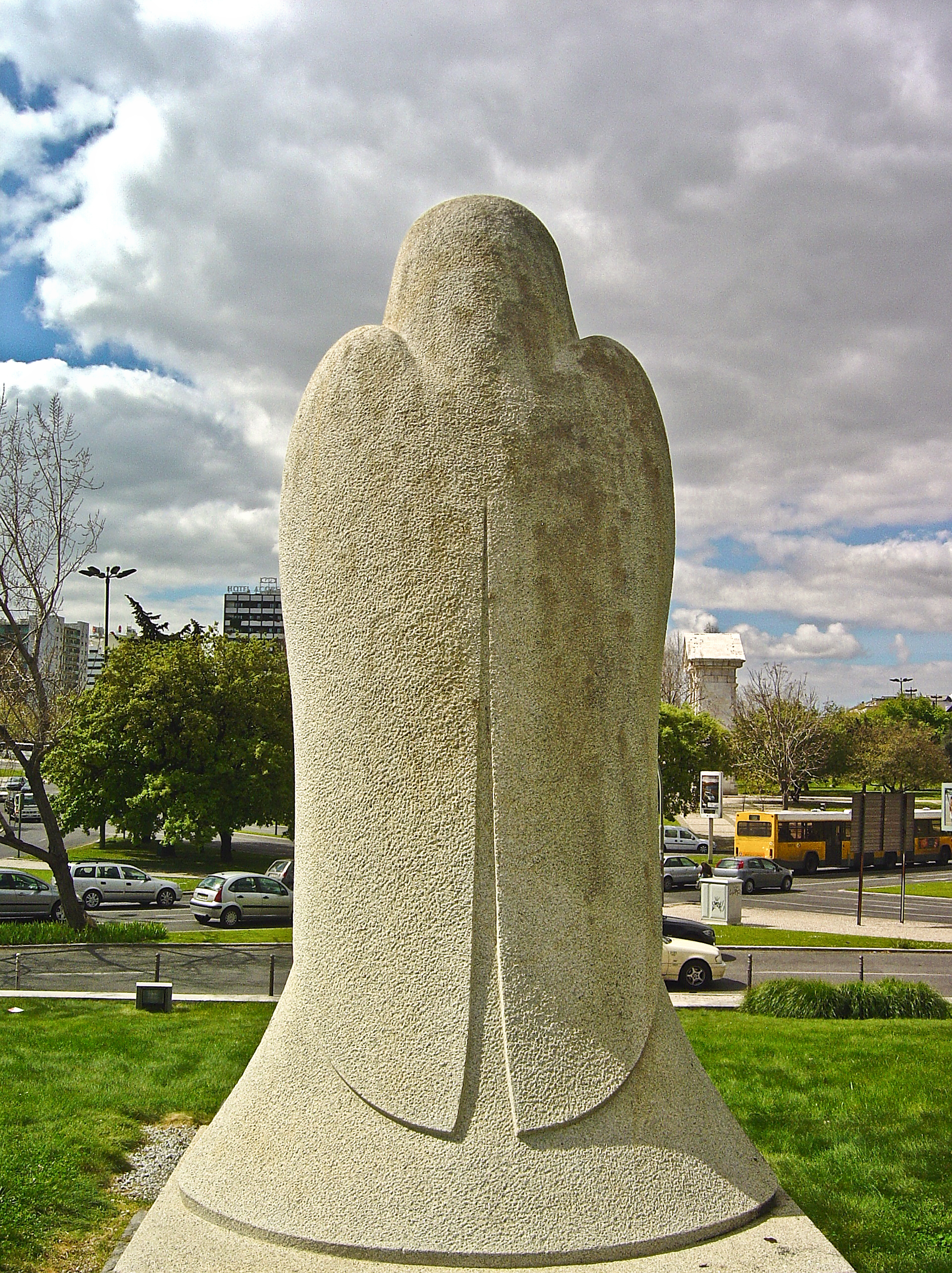
Calouste Sarkis Gulbenkian nasceu em Istambul em 1869 e era descendente de uma família abastada de arménios, tendo falecido em Lisboa a 25 de Julho de 1955. Licenciado em Engenharia no ano de 1887, no Kin`s College em Londres, foi pioneiro no desenvolvimento petrolífero do Médio Oriente, duro negociador, um excepcional perito financeiro e uma mecenas das artes com um apurado sentido estético. Da sua grande fortuna soube distribuí-la de forma generosa. Durante a II Guerra Mundial veio para Portugal onde fixou residência permanente. Após a sua morte, em 1955, em testamento criou a Fundação de seu nome, com fins caritativos, artísticos, educativos e científicos. Nos vastos jardins desta Fundação encontram-se várias estátuas e, entre elas, a do fundador, da autoria de Leopoldo de Almeida, inaugurada em 20 de Julho de 1965. Ali se encontra o Museu com as obras do autor,o Centro de Arte Moderna, integrando um Museu e um Centro de Documentação, inaugurado em 1983, anfiteatros, auditórios polivalentes, uma zona de congressos, diversas galerias de exposição e uma biblioteca de arte e de história, literatura e cultura portuguesa. <a href="http://www.lifecooler.com/portugal/patrimonio/EstatuadeCalousteGulbenkian">www.lifecooler.com/portugal/patrimonio/EstatuadeCalousteG...</a>
|
| Date | |
| Source | Monumento a Calouste Gulbenkian - Lisboa - Portugal |
| Author | Vitor Oliveira from Torres Vedras, PORTUGAL |
| Object location | | View this and other nearby images on: OpenStreetMap |
|---|
.jpg¶ms=038.737290_N_-009.155820_E_globe:Earth_class:object_type:object__&language=en)
| Camera location | | View this and other nearby images on: OpenStreetMap |
|---|
.jpg¶ms=038.737290_N_-009.155760_E_globe:Earth_type:camera_source:Flickr_&language=en)
Licensing[edit]
.jpg&action=edit§ion=2)
- You are free:
- to share – to copy, distribute and transmit the work
- to remix – to adapt the work
- Under the following conditions:
- attribution – You must give appropriate credit, provide a link to the license, and indicate if changes were made. You may do so in any reasonable manner, but not in any way that suggests the licensor endorses you or your use.
- share alike – If you remix, transform, or build upon the material, you must distribute your contributions under the same or compatible license as the original.
| This image was originally posted to Flickr by Portuguese_eyes at https://flickr.com/photos/21446942@N00/3133933992 (archive). It was reviewed on 19 March 2019 by FlickreviewR 2 and was confirmed to be licensed under the terms of the cc-by-sa-2.0. |
File history
Click on a date/time to view the file as it appeared at that time.
| Date/Time | Thumbnail | Dimensions | User | Comment | |
|---|---|---|---|---|---|
| current | 00:31, 19 March 2019 | | 3,840 × 5,136 (14.07 MB) | Tm (talk | contribs) | Transferred from Flickr via #flickr2commons |
You cannot overwrite this file.
File usage on Commons
There are no pages that use this file.
.jpg&oldid=664777460)