File:Montgomerytownships.PNG
Jump to navigation
Jump to search
Size of this preview: 563 × 600 pixels. Other resolutions: 225 × 240 pixels | 451 × 480 pixels | 724 × 771 pixels.
Original file (724 × 771 pixels, file size: 57 KB, MIME type: image/png)
Captions
Captions
Add a one-line explanation of what this file represents
Summary[edit]
| Description |
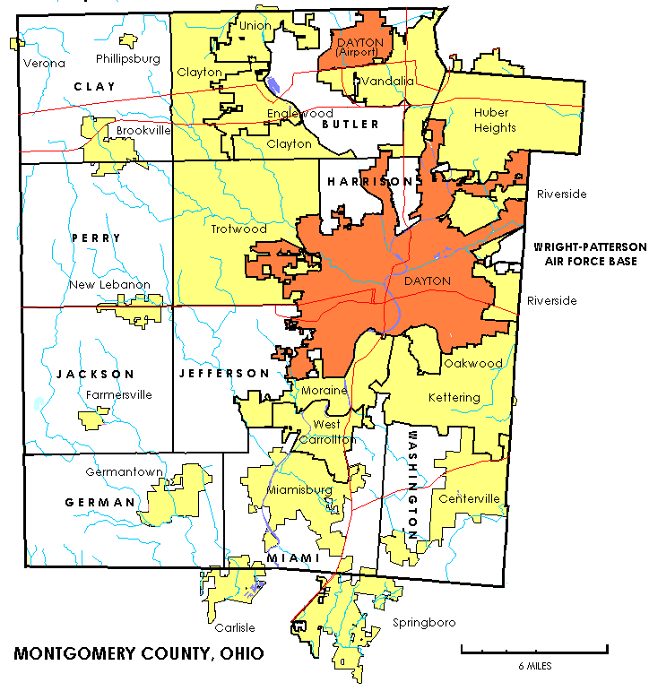
English: The image depicts the administrative divisions of Montgomery County, Ohio; cities, villages, CDPs, and townships |
| Source | Self-created from US Federal Census maps and data. |
| Author | United States Census Bureau |
Licensing[edit]
This image or file is a work of a United States Census Bureau employee, taken or made as part of that person's official duties. As a work of the U.S. federal government, the image is in the public domain.
|
 |
Original upload log[edit]
The original description page was here. All following user names refer to en.wikipedia.
- 2006-06-20 21:50 Prinzwilhelm 724×771× (58876 bytes) Self-created from US Federal Census maps and data.)
- 2006-06-20 21:48 Prinzwilhelm 724×771× (58599 bytes) Self-created from US Federal Census maps and data.) (version lost by MediaWiki)
- 2006-06-20 20:47 Prinzwilhelm 724×771× (58613 bytes) Self-created from US Federal Census maps and data.) (version lost by MediaWiki)
- 2006-06-20 17:24 Prinzwilhelm 724×771× (58465 bytes) Self-created from US Federal Census maps and data. (version lost by MediaWiki)
- 2006-06-20 16:51 Prinzwilhelm 724×771× (58371 bytes) Self-created from US Federal Census maps and data. (version lost by MediaWiki)
File history
Click on a date/time to view the file as it appeared at that time.
| Date/Time | Thumbnail | Dimensions | User | Comment | |
|---|---|---|---|---|---|
| current | 23:57, 14 January 2012 | | 724 × 771 (57 KB) | Wars (talk | contribs) |
You cannot overwrite this file.
File usage on Commons
There are no pages that use this file.
File usage on other wikis
The following other wikis use this file:
- Usage on de.wikipedia.org
- Usage on en.wikipedia.org
- Usage on ja.wikipedia.org
- Usage on nl.wikipedia.org
- Usage on ro.wikipedia.org