File:Montenegro Referendum 2006.png
Jump to navigation
Jump to search
Size of this preview: 491 × 599 pixels. Other resolutions: 197 × 240 pixels | 393 × 480 pixels | 629 × 768 pixels | 1,092 × 1,333 pixels.
Original file (1,092 × 1,333 pixels, file size: 25 KB, MIME type: image/png)
Captions
Captions
Add a one-line explanation of what this file represents

|
This map has been uploaded by Electionworld from en.wikipedia.org to enable the |
Summary[edit]
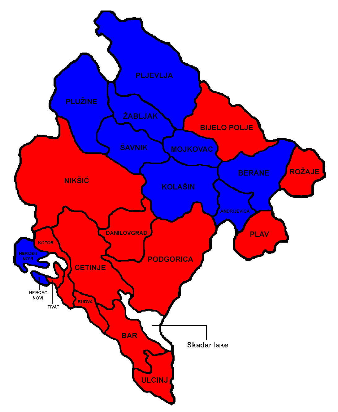
This image shows the results of the Montenegrin independence referendum, 2006, with red municipalities having returned a majority for independence, and blue municipalities having returned a majority for remaining in the union.
Based upon the wikipedia public domain image: Image:Montenegro municipalities.png

.
Licensing[edit]
| I, the copyright holder of this work, release this work into the public domain. This applies worldwide. In some countries this may not be legally possible; if so: I grant anyone the right to use this work for any purpose, without any conditions, unless such conditions are required by law. |
File history
Click on a date/time to view the file as it appeared at that time.
| Date/Time | Thumbnail | Dimensions | User | Comment | |
|---|---|---|---|---|---|
| current | 22:59, 22 December 2006 | | 1,092 × 1,333 (25 KB) | Electionworld (talk | contribs) | {{ew|en|Neil Tarrant}} == Summary == This image shows the results of the Montenegrin independence referendum, 2006, with red municipalities having returned a majority for independence, and blue municipalities having returned a majority for remaining i |
You cannot overwrite this file.
File usage on Commons
The following page uses this file:
File usage on other wikis
The following other wikis use this file:
- Usage on en.wikipedia.org