File:Mohnenfluhsattel Panorama.jpg
Jump to navigation
Jump to search

Size of this preview: 800 × 190 pixels. Other resolutions: 320 × 76 pixels | 640 × 152 pixels | 1,024 × 243 pixels | 1,280 × 304 pixels | 2,560 × 608 pixels | 8,649 × 2,054 pixels.
Original file (8,649 × 2,054 pixels, file size: 13.84 MB, MIME type: image/jpeg)
Captions
Captions
Add a one-line explanation of what this file represents
| Description |
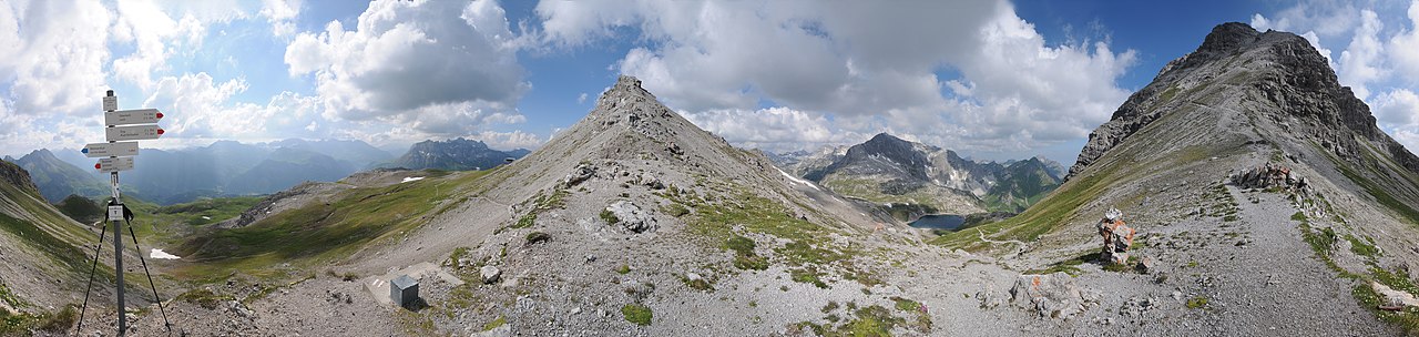
Deutsch: Panorama vom 2.315m hohen Mohnenfluhsattel. Rechts zieht sich der Pfad in Serpentinen zur 2.544m hohen Mohnenfluh. Die Wege zum Butzensee führen weiter zur Braunarlspitze oder hinunter über den Jägersteig ins Felletal nach Schröcken.
|
||
| Date | |||
| Source | Own work | ||
| Author | böhringer friedrich | ||
| Permission (Reusing this file) |
I, the copyright holder of this work, hereby publish it under the following license: This file is licensed under the Creative Commons Attribution-Share Alike 2.5 Generic license.
|
||
| Other versions |

| Camera location | | View this and other nearby images on: OpenStreetMap |
|---|
This Photo was taken by Böhringer Friedrich.
|
Feel free to use my photos, but please mention me as the author and if you want send me a message. or (rufre@lenz-nenning.at) |
| Annotations | This image is annotated: View the annotations at Commons |
File history
Click on a date/time to view the file as it appeared at that time.
| Date/Time | Thumbnail | Dimensions | User | Comment | |
|---|---|---|---|---|---|
| current | 19:14, 30 June 2011 | 8,649 × 2,054 (13.84 MB) | Böhringer (talk | contribs) | {{Pano360|horizon=65}} {{Information |Description= {{de|Panorama vom 2.315m hohen Mohnenfluhsattel. Rechts zieht sich der Pfad in Serpentinen zur 2.544m hohen Mohnenfluh. Die Wege zum Butzensee führen we |
You cannot overwrite this file.
File usage on Commons
The following page uses this file: