File:Mogilev oblast location map.svg
Jump to navigation
Jump to search

Size of this PNG preview of this SVG file: 800 × 525 pixels. Other resolutions: 320 × 210 pixels | 640 × 420 pixels | 1,024 × 672 pixels | 1,280 × 840 pixels | 2,560 × 1,680 pixels.
Original file (SVG file, nominally 1,024 × 672 pixels, file size: 126 KB)
Captions
Captions
Add a one-line explanation of what this file represents
Summary[edit]
| Description |
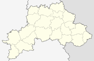
Русский: Позиционная карта Могилёвской области
Цилиндрическая равноугольная проекция с координатами краёв:
|
| Date | |
| Source | Own work на основе карты из Openstreetmap |
| Author |
This W3C-unspecified vector image was created with Inkscape . |
Licensing[edit]
I, the copyright holder of this work, hereby publish it under the following license:
This file is licensed under the Creative Commons Attribution-Share Alike 3.0 Unported license.
- You are free:
- to share – to copy, distribute and transmit the work
- to remix – to adapt the work
- Under the following conditions:
- attribution – You must give appropriate credit, provide a link to the license, and indicate if changes were made. You may do so in any reasonable manner, but not in any way that suggests the licensor endorses you or your use.
- share alike – If you remix, transform, or build upon the material, you must distribute your contributions under the same or compatible license as the original.
File history
Click on a date/time to view the file as it appeared at that time.
| Date/Time | Thumbnail | Dimensions | User | Comment | |
|---|---|---|---|---|---|
| current | 12:32, 2 April 2013 | | 1,024 × 672 (126 KB) | Dimitrius (talk | contribs) | User created page with UploadWizard |
You cannot overwrite this file.
File usage on Commons
The following 13 pages use this file:
- Category:Births in Mogilev Region
- Category:Catholic churches in Mogilev Region
- Category:Cultural heritage monuments in Mogilev Region
- Category:Culture of Mogilev Region
- Category:Districts of Mahilioŭ Region
- Category:History of Mogilev Region
- Category:Maps of Mahilioŭ Region
- Category:Mogilev Region
- Category:Orthodox churches in Mahilioŭ Region
- Category:Populated places in Mahilioŭ Region
- Category:Protected areas of Mogilev Region
- Category:Rivers of Mahilioŭ Region
- Category:Train stations in Mahilioŭ Region
File usage on other wikis
The following other wikis use this file:
- Usage on ar.wikipedia.org
- Usage on ast.wikipedia.org
- Usage on az.wikipedia.org
- Usage on be-tarask.wikipedia.org
- Магілёў
- Бабруйск
- Шклоў
- Крычаў
- Амсьціслаў
- Асіпавічы
- Ганчароўка (Бабруйскі раён)
- Горкі
- Клічаў
- Быхаў
- Бялынічы
- Глуск
- Касьцюковічы
- Дрыбін
- Клімавічы
- Прапойск
- Чэрыкаў
- Чавусы
- Хоцімск
- Качэрычы
- Краснапольле
- Скачок (Магілёўская вобласьць)
- Расна
- Хімы (Магілёўская вобласьць)
- Лейчыцы
- Міраціна
- Пабокавічы (Бабруйскі раён)
- Вялічкава
- Сідаравічы (Магілёўская вобласьць)
- Гавяды
- Міхалёва 1
- Міхалёва 2
- Міхалёва 3
- Каты (Бабруйскі раён)
- Машкі (Магілёўская вобласьць)
- Новая Шараеўшчына
- Новая Беларусь
- Палошкава (Бабруйскі раён)
- Міхайлаўка (Бабруйскі раён)
- Шапялевічы
- Слабада (Хімоўскі сельсавет)
- Ліцьвінава (Крычаўскі раён)
- Ліцьвінава (Асіпавіцкі раён)
- Ліпнякі (Магілёўская вобласьць)
- Узнога (Бабруйскі раён)
- Марцінаўка (Бабруйскі раён)
- Лебядзёўка (Бабруйскі раён)
View more global usage of this file.