File:Miklouho-Maclay Oceania Map DEC1883.jpg
Jump to navigation
Jump to search

Size of this preview: 771 × 600 pixels. Other resolutions: 309 × 240 pixels | 617 × 480 pixels | 988 × 768 pixels | 1,280 × 996 pixels | 1,998 × 1,554 pixels.
Original file (1,998 × 1,554 pixels, file size: 1.23 MB, MIME type: image/jpeg)
Captions
Captions
Add a one-line explanation of what this file represents
Summary
[edit]
| Description |
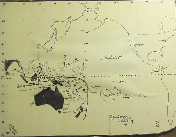
English: Miklouho-Maclay Oceania Map DEC 1883 Русский: Карта Никола́я Никола́евича Миклу́хо-Макла́я предполагаемых территориальных приобретений России в Тихом океане, поданная в письме Александру III, декабрь 1883 год. |
| Date | |
| Source | Музей Мирового океана, Калининград / Museum of the World Ocean |
| Author | Никола́й Никола́евич Миклу́хо-Макла́й / Nicholas Miklouho-Maclay |
Licensing
[edit]
|
This work is in the public domain in its country of origin and other countries and areas where the copyright term is the author's life plus 100 years or fewer. | |
| This file has been identified as being free of known restrictions under copyright law, including all related and neighboring rights. | |
File history
Click on a date/time to view the file as it appeared at that time.
| Date/Time | Thumbnail | Dimensions | User | Comment | |
|---|---|---|---|---|---|
| current | 10:20, 5 July 2015 | | 1,998 × 1,554 (1.23 MB) | Niklitov (talk | contribs) | User created page with UploadWizard |
You cannot overwrite this file.
File usage on Commons
There are no pages that use this file.
File usage on other wikis
The following other wikis use this file:
- Usage on ba.wikipedia.org
- Usage on hy.wikipedia.org
- Usage on ru.wikipedia.org
- Usage on uk.wikipedia.org