File:Middle Miocene South America.png
Jump to navigation
Jump to search

Size of this preview: 800 × 600 pixels. Other resolutions: 320 × 240 pixels | 640 × 480 pixels | 1,024 × 768 pixels | 1,280 × 960 pixels | 1,455 × 1,091 pixels.
Original file (1,455 × 1,091 pixels, file size: 135 KB, MIME type: image/png)
Captions
Captions
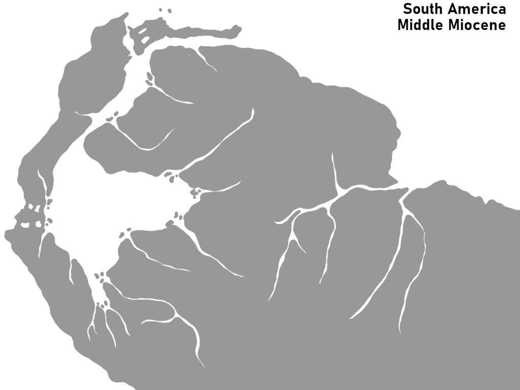
Map of South America during the middle Miocene (ca. 23 - 10 Ma)
Summary[edit]
| Description |
English: Map of northern South America during the Middle Pliocene (ca. 23 - 10 Ma) with focus on the Pebas Mega-Wetlands prior to the establishing of the cross-continental Amazone drainage.[1] |
| Date | |
| Source | Own work |
| Author | Armin Reindl |
Licensing[edit]
I, the copyright holder of this work, hereby publish it under the following license:
This file is licensed under the Creative Commons Attribution-Share Alike 4.0 International license.
- You are free:
- to share – to copy, distribute and transmit the work
- to remix – to adapt the work
- Under the following conditions:
- attribution – You must give appropriate credit, provide a link to the license, and indicate if changes were made. You may do so in any reasonable manner, but not in any way that suggests the licensor endorses you or your use.
- share alike – If you remix, transform, or build upon the material, you must distribute your contributions under the same or compatible license as the original.
- ↑ (2020). "Predation of the giant Miocene caiman Purussaurus on a mylodontid ground sloth in the wetlands of proto-Amazonia". Biology Letters 16 (8). DOI:1098/rsbl.2020.0239.
File history
Click on a date/time to view the file as it appeared at that time.
| Date/Time | Thumbnail | Dimensions | User | Comment | |
|---|---|---|---|---|---|
| current | 01:17, 27 December 2021 | | 1,455 × 1,091 (135 KB) | Armin Reindl (talk | contribs) | Uploaded own work with UploadWizard |
You cannot overwrite this file.
File usage on Commons
The following page uses this file:
File usage on other wikis
The following other wikis use this file:
- Usage on en.wikipedia.org
- Usage on it.wikipedia.org