File:Middle Eastern terrain.jpg
Jump to navigation
Jump to search

Size of this preview: 666 × 600 pixels. Other resolutions: 267 × 240 pixels | 533 × 480 pixels | 853 × 768 pixels | 1,137 × 1,024 pixels | 2,275 × 2,048 pixels | 3,554 × 3,200 pixels.
Original file (3,554 × 3,200 pixels, file size: 11.01 MB, MIME type: image/jpeg)
Captions
Captions
Add a one-line explanation of what this file represents
Summary[edit]
| Middle Eastern terrain | |
|---|---|
| Photographer |
Envisat satellite |
| Title |
Middle Eastern terrain |
| Description |
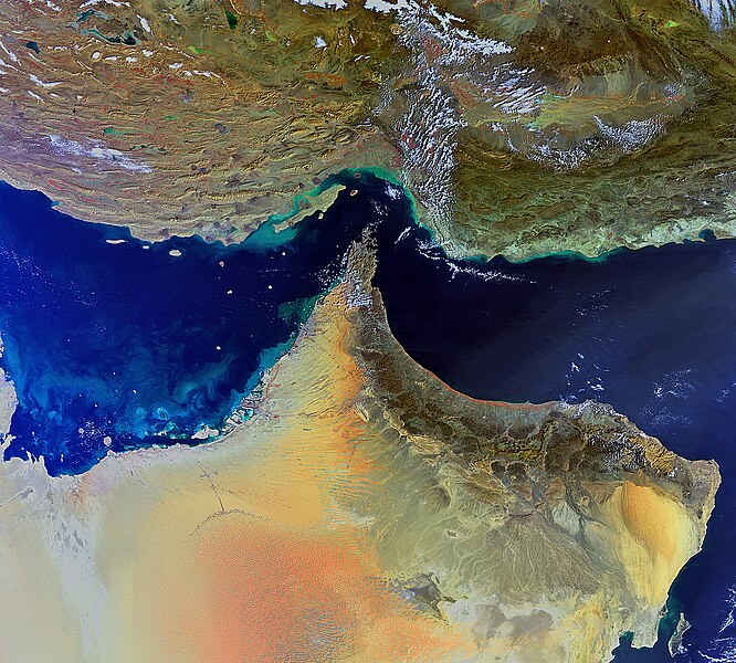
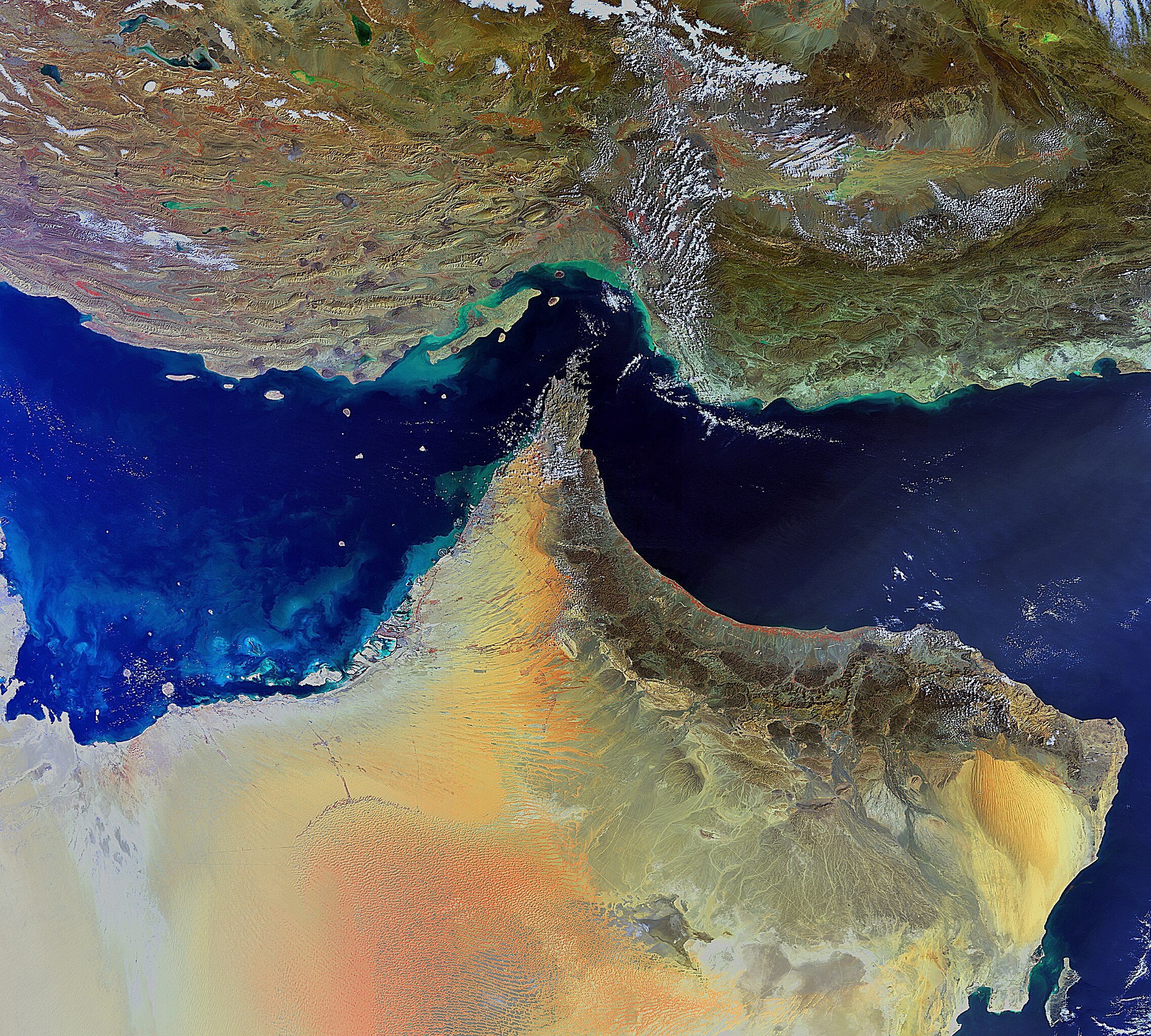
English: The south-eastern parts of Iran (top) and the Arabian Peninsula are featured in this image, acquired by Envisat’s Medium Resolution Imaging Spectrometer on 4 February 2011. The closest point between the two Middle Eastern countries is the Strait of Hormuz (centre), which links the Persian Gulf (left) with the Gulf of Oman (upper right) and the Arabian Sea (lower right). Several countries are visible on the peninsula: the United Arab Emirates (top left), Oman (tip and bottom right) and Saudi Arabia (far left and bottom). |
| Depicted place | Strait of Hormuz |
| Date | 4 February 2011 |
| Collection | European Space Agency |
| Accession number |
213522 |
| Credit line | ESA |
| Source | http://www.esa.int/spaceinimages/Images/2011/03/Middle_Eastern_terrain |
Licensing[edit]
This file is licensed under the Creative Commons Attribution-ShareAlike 3.0 IGO license.
- You are free:
- to share – to copy, distribute and transmit the work
- to remix – to adapt the work
- Under the following conditions:
- attribution – You must give appropriate credit, provide a link to the license, and indicate if changes were made. You may do so in any reasonable manner, but not in any way that suggests the licensor endorses you or your use.
- share alike – If you remix, transform, or build upon the material, you must distribute your contributions under the same or compatible license as the original.
File history
Click on a date/time to view the file as it appeared at that time.
| Date/Time | Thumbnail | Dimensions | User | Comment | |
|---|---|---|---|---|---|
| current | 01:42, 25 February 2017 | | 3,554 × 3,200 (11.01 MB) | Revent (talk | contribs) | =={{int:filedesc}}== {{Photograph |photographer = Envisat satellite |title = Middle Eastern terrain |description = {{en|The south-eastern parts of Iran (top) and the Arabian Peninsula are featured in this image, acquired by... |
You cannot overwrite this file.
File usage on Commons
The following 4 pages use this file: