File:Mexican map en 1838.PNG
Jump to navigation
Jump to search

Size of this preview: 674 × 600 pixels. Other resolutions: 270 × 240 pixels | 540 × 480 pixels | 863 × 768 pixels | 1,151 × 1,024 pixels | 1,478 × 1,315 pixels.
Original file (1,478 × 1,315 pixels, file size: 93 KB, MIME type: image/png)
Captions
Captions
Add a one-line explanation of what this file represents
Summary[edit]
| Description |
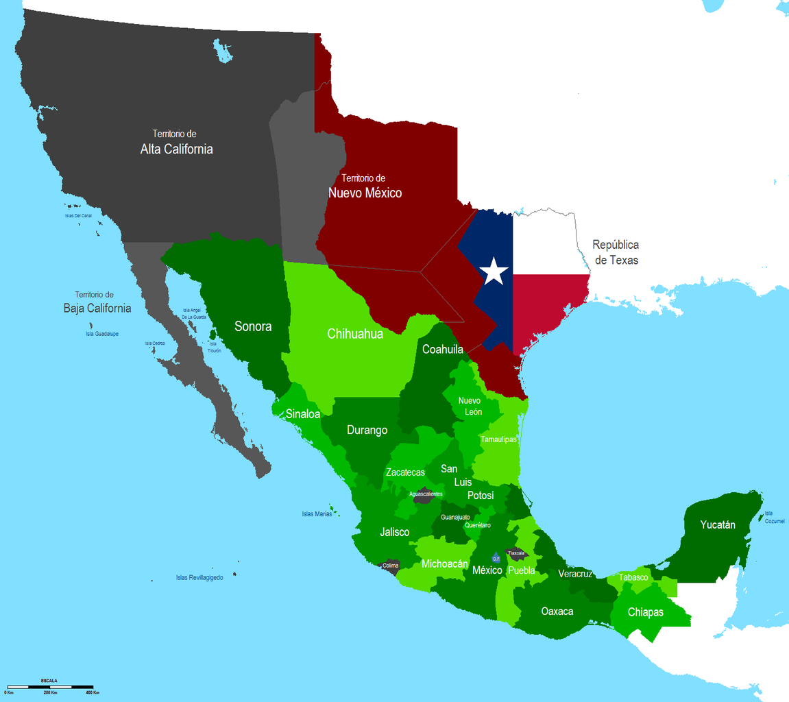
Deutsch: Karte von Mexiko 1838. Darin enthalten die im Mexikanisch-Amerikanischen Krieg 1846-1848 abgetretenen Gebiete Alta California, Nuevo Mexico und der unabhängig gewordene Staat Texas.
English: Map of Mexico 1838
Español: Mapa de Mexico en 1838 |
||
| Source | Own work | ||
| Author | Jaimiko | ||
| Other versions |
|

Licensing[edit]
| I, the copyright holder of this work, release this work into the public domain. This applies worldwide. In some countries this may not be legally possible; if so: I grant anyone the right to use this work for any purpose, without any conditions, unless such conditions are required by law. |
File history
Click on a date/time to view the file as it appeared at that time.
| Date/Time | Thumbnail | Dimensions | User | Comment | |
|---|---|---|---|---|---|
| current | 07:47, 28 January 2010 | | 1,478 × 1,315 (93 KB) | Jaimiko (talk | contribs) | Nuevo modelo de imagen. |
| 11:30, 4 December 2009 |  | 1,478 × 1,315 (121 KB) | Jaimiko (talk | contribs) | correccion de los margenes y limites fronterizos correction of the margins and border boundaries | |
| 22:27, 6 May 2009 |  | 1,635 × 1,385 (133 KB) | Jaimiko (talk | contribs) | {{Information |Description={{en|1=Map of Mexico 1838}} {{es|1=Mapa de Mexico en 1838}} |Source=trabajo propio (own work) |Author=Jaimiko |Date= |Permission= |other_versions= }} <!--{{ImageUpload|full}}--> Category:Maps of Mexico |
You cannot overwrite this file.
File usage on Commons
There are no pages that use this file.
File usage on other wikis
The following other wikis use this file: