File:Metro Tehran Map.png
Jump to navigation
Jump to search

Size of this preview: 788 × 600 pixels. Other resolutions: 315 × 240 pixels | 631 × 480 pixels | 854 × 650 pixels.
Original file (854 × 650 pixels, file size: 31 KB, MIME type: image/png)
Captions
Captions
Add a one-line explanation of what this file represents
Summary[edit]
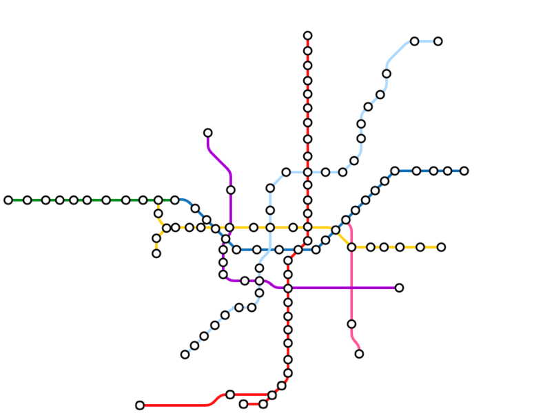
| Description |
فارسی: نقشه مترو تهران |
| Date | |
| Source | Own work |
| Author | Nima Farid |
Licensing[edit]
I, the copyright holder of this work, hereby publish it under the following license:
| This file is made available under the Creative Commons CC0 1.0 Universal Public Domain Dedication. | |
| The person who associated a work with this deed has dedicated the work to the public domain by waiving all of their rights to the work worldwide under copyright law, including all related and neighboring rights, to the extent allowed by law. You can copy, modify, distribute and perform the work, even for commercial purposes, all without asking permission.
|
File history
Click on a date/time to view the file as it appeared at that time.
| Date/Time | Thumbnail | Dimensions | User | Comment | |
|---|---|---|---|---|---|
| current | 02:44, 29 September 2019 | | 854 × 650 (31 KB) | BasilLeaf (talk | contribs) | line 6 extension |
| 16:15, 2 September 2019 |  | 854 × 650 (31 KB) | BasilLeaf (talk | contribs) | Update and fix, line 7 east extension | |
| 16:57, 14 April 2019 |  | 854 × 650 (32 KB) | BasilLeaf (talk | contribs) | fix | |
| 07:46, 2 September 2017 |  | 854 × 639 (35 KB) | BasilLeaf (talk | contribs) | ایستگاه شهید محلاتی | |
| 20:12, 14 August 2017 |  | 854 × 639 (35 KB) | BasilLeaf (talk | contribs) | Line 8 Airport line extended added | |
| 02:23, 14 July 2017 |  | 854 × 639 (35 KB) | BasilLeaf (talk | contribs) | Line 7 added | |
| 01:55, 7 February 2017 |  | 854 × 627 (33 KB) | BasilLeaf (talk | contribs) | ایستگاه هروی | |
| 15:18, 16 December 2016 |  | 854 × 627 (33 KB) | BasilLeaf (talk | contribs) | ایستگاه حسین آباد | |
| 17:53, 8 November 2016 |  | 854 × 627 (32 KB) | BasilLeaf (talk | contribs) | update | |
| 01:02, 20 September 2016 |  | 854 × 627 (32 KB) | BasilLeaf (talk | contribs) | مترو شهید قدوسی |
You cannot overwrite this file.
File usage on Commons
The following 62 pages use this file:
- User:Chumwa/OgreBot/Potential transport maps/2016 April 21-30
- User:Chumwa/OgreBot/Potential transport maps/2016 August 11-20
- User:Chumwa/OgreBot/Potential transport maps/2016 December 11-20
- User:Chumwa/OgreBot/Potential transport maps/2016 February 10-19
- User:Chumwa/OgreBot/Potential transport maps/2016 June 1-10
- User:Chumwa/OgreBot/Potential transport maps/2016 November 1-10
- User:Chumwa/OgreBot/Potential transport maps/2016 September 11-20
- User:Chumwa/OgreBot/Potential transport maps/2017 August 11-20
- User:Chumwa/OgreBot/Potential transport maps/2017 February 1-9
- User:Chumwa/OgreBot/Potential transport maps/2017 July 11-20
- User:Chumwa/OgreBot/Potential transport maps/2017 September 1-10
- User:Chumwa/OgreBot/Potential transport maps/2019 April 11-20
- User:Chumwa/OgreBot/Potential transport maps/2019 September 1-10
- User:Chumwa/OgreBot/Potential transport maps/2019 September 21-30
- User:Chumwa/OgreBot/Public transport information/2015 June 21-30
- User:Chumwa/OgreBot/Public transport information/2015 November 11-20
- User:Chumwa/OgreBot/Public transport information/2015 September 21-30
- User:Chumwa/OgreBot/Public transport information/2016 April 21-30
- User:Chumwa/OgreBot/Public transport information/2016 August 11-20
- User:Chumwa/OgreBot/Public transport information/2016 December 11-20
- User:Chumwa/OgreBot/Public transport information/2016 February 10-19
- User:Chumwa/OgreBot/Public transport information/2016 June 1-10
- User:Chumwa/OgreBot/Public transport information/2016 November 1-10
- User:Chumwa/OgreBot/Public transport information/2016 September 11-20
- User:Chumwa/OgreBot/Public transport information/2017 August 11-20
- User:Chumwa/OgreBot/Public transport information/2017 February 1-9
- User:Chumwa/OgreBot/Public transport information/2017 July 11-20
- User:Chumwa/OgreBot/Public transport information/2017 September 1-10
- User:Chumwa/OgreBot/Public transport information/2019 April 11-20
- User:Chumwa/OgreBot/Public transport information/2019 September 1-10
- User:Chumwa/OgreBot/Public transport information/2019 September 21-30
- User:Chumwa/OgreBot/Transport Maps/2015 June 21-30
- User:Chumwa/OgreBot/Transport Maps/2015 November 11-20
- User:Chumwa/OgreBot/Transport Maps/2015 September 21-30
- User:Chumwa/OgreBot/Transport Maps/2016 April 21-30
- User:Chumwa/OgreBot/Transport Maps/2016 August 11-20
- User:Chumwa/OgreBot/Transport Maps/2016 December 11-20
- User:Chumwa/OgreBot/Transport Maps/2016 February 10-19
- User:Chumwa/OgreBot/Transport Maps/2016 June 1-10
- User:Chumwa/OgreBot/Transport Maps/2016 November 1-10
- User:Chumwa/OgreBot/Transport Maps/2016 September 11-20
- User:Chumwa/OgreBot/Transport Maps/2017 August 11-20
- User:Chumwa/OgreBot/Transport Maps/2017 February 1-9
- User:Chumwa/OgreBot/Transport Maps/2017 July 11-20
- User:Chumwa/OgreBot/Transport Maps/2017 September 1-10
- User:Chumwa/OgreBot/Transport Maps/2019 April 11-20
- User:Chumwa/OgreBot/Transport Maps/2019 September 1-10
- User:Chumwa/OgreBot/Transport Maps/2019 September 21-30
- User:Chumwa/OgreBot/Travel and communication maps/2016 April 21-30
- User:Chumwa/OgreBot/Travel and communication maps/2016 August 11-20
- User:Chumwa/OgreBot/Travel and communication maps/2016 December 11-20
- User:Chumwa/OgreBot/Travel and communication maps/2016 February 10-19
- User:Chumwa/OgreBot/Travel and communication maps/2016 June 1-10
- User:Chumwa/OgreBot/Travel and communication maps/2016 November 1-10
- User:Chumwa/OgreBot/Travel and communication maps/2016 September 11-20
- User:Chumwa/OgreBot/Travel and communication maps/2017 August 11-20
- User:Chumwa/OgreBot/Travel and communication maps/2017 February 1-9
- User:Chumwa/OgreBot/Travel and communication maps/2017 July 11-20
- User:Chumwa/OgreBot/Travel and communication maps/2017 September 1-10
- User:Chumwa/OgreBot/Travel and communication maps/2019 April 11-20
- User:Chumwa/OgreBot/Travel and communication maps/2019 September 1-10
- User:Chumwa/OgreBot/Travel and communication maps/2019 September 21-30
File usage on other wikis
The following other wikis use this file:
- Usage on az.wikipedia.org
- Usage on www.wikidata.org
- Usage on zh.wikipedia.org