File:Mauritania Morocco Locator.png
Jump to navigation
Jump to search

Size of this preview: 800 × 423 pixels. Other resolutions: 320 × 169 pixels | 640 × 338 pixels | 978 × 517 pixels.
Original file (978 × 517 pixels, file size: 25 KB, MIME type: image/png)
Captions
Captions
Add a one-line explanation of what this file represents
Summary

|
This file was moved to Wikimedia Commons from en.wikipedia using a bot script. All source information is still present. It requires review. Additionally, there may be errors in any or all of the information fields; information on this file should not be considered reliable and the file should not be used until it has been reviewed and any needed corrections have been made. Once the review has been completed, this template should be removed. For details about this file, see below. Check now! |
| Description |
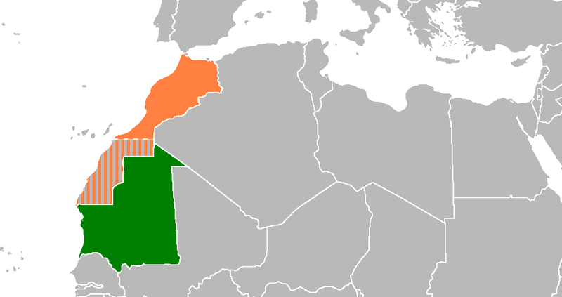
English: Locator map showing Mauritania and Morocco |
| Date | |
| Source | self-made based on :Image:BlankMap-World6 |
| Author | Omar-Toons |
Licensing
| This work has been released into the public domain by its author, Omar-Toons at English Wikipedia. This applies worldwide. In some countries this may not be legally possible; if so: Omar-Toons grants anyone the right to use this work for any purpose, without any conditions, unless such conditions are required by law. |
Original upload log
Transferred from en.wikipedia to Commons by Luan using CommonsHelper.
The original description page was here. All following user names refer to en.wikipedia.
- 2011-02-23 20:30 Omar-Toons 978×517× (25464 bytes)
File history
Click on a date/time to view the file as it appeared at that time.
| Date/Time | Thumbnail | Dimensions | User | Comment | |
|---|---|---|---|---|---|
| current | 19:15, 21 November 2020 | | 978 × 517 (25 KB) | Christian Ferrer (talk | contribs) | Reverted to version as of 18:52, 21 November 2020 (UTC) |
| 18:55, 21 November 2020 |  | 800 × 423 (67 KB) | Taha Khattabi (talk | contribs) | Reverted to version as of 18:42, 21 November 2020 (UTC) | |
| 18:52, 21 November 2020 |  | 978 × 517 (25 KB) | M.Bitton (talk | contribs) | Reverted to version as of 18:20, 21 November 2020 (UTC) | |
| 18:42, 21 November 2020 |  | 800 × 423 (67 KB) | Taha Khattabi (talk | contribs) | Reverted to version as of 21:31, 25 March 2016 (UTC) | |
| 18:20, 21 November 2020 |  | 978 × 517 (25 KB) | M.Bitton (talk | contribs) | Reverted to version as of 20:49, 31 March 2016 (UTC) | |
| 06:55, 21 November 2020 |  | 800 × 423 (67 KB) | Taha Khattabi (talk | contribs) | There is a border between Morocco and Mauritania, Western Sahara is part of Morocco. | |
| 20:49, 31 March 2016 |  | 978 × 517 (25 KB) | Fry1989 (talk | contribs) | Reverted to version as of 16:33, 4 March 2012 (UTC) | |
| 21:31, 25 March 2016 |  | 800 × 423 (67 KB) | Hpyounes (talk | contribs) | better colors | |
| 01:48, 23 October 2015 |  | 978 × 517 (21 KB) | Hpyounes (talk | contribs) | correction | |
| 16:33, 4 March 2012 |  | 978 × 517 (25 KB) | File Upload Bot (Magnus Manske) (talk | contribs) | {{BotMoveToCommons|en.wikipedia|year={{subst:CURRENTYEAR}}|month={{subst:CURRENTMONTHNAME}}|day={{subst:CURRENTDAY}}}} {{Information |Description={{en|Locator map showing Mauritania and Morocco<br/> en:Category:Mauritania–Morocco relations}} |... |
You cannot overwrite this file.
File usage on Commons
The following page uses this file:
File usage on other wikis
The following other wikis use this file:
- Usage on ca.wikipedia.org
- Usage on de.wikipedia.org
- Usage on en.wikipedia.org
- Usage on fr.wikipedia.org
- Usage on pt.wikipedia.org
- Usage on ru.wikipedia.org
- Usage on www.wikidata.org