File:Mappa ferrovia Modena-Mirandola.svg
Jump to navigation
Jump to search

Size of this PNG preview of this SVG file: 507 × 600 pixels. Other resolutions: 203 × 240 pixels | 406 × 480 pixels | 649 × 768 pixels | 866 × 1,024 pixels | 1,731 × 2,048 pixels | 1,345 × 1,591 pixels.
Original file (SVG file, nominally 1,345 × 1,591 pixels, file size: 218 KB)
Captions
Captions
Add a one-line explanation of what this file represents
Summary[edit]
| Description |
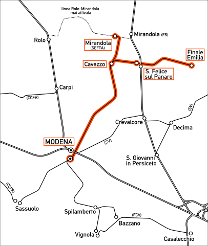
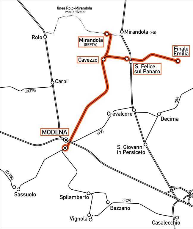
Italiano: Mappa della ferrovia Modena-Mirandola con diramazione Cavezzo-Finale Emilia. |
|||
| Source | Own work | |||
| Author | Arbalete | |||
| Permission (Reusing this file) |
I, the copyright holder of this work, hereby publish it under the following license: This file is licensed under the Creative Commons Attribution-Share Alike 4.0 International license.
|
|||
| Other versions |
|


File history
Click on a date/time to view the file as it appeared at that time.
| Date/Time | Thumbnail | Dimensions | User | Comment | |
|---|---|---|---|---|---|
| current | 04:38, 7 April 2016 | | 1,345 × 1,591 (218 KB) | Arbalete (talk | contribs) | User created page with UploadWizard |
You cannot overwrite this file.
File usage on Commons
The following 5 pages use this file: