File:Mappa Independent Subway System.png
Jump to navigation
Jump to search
Size of this preview: 561 × 599 pixels. Other resolutions: 225 × 240 pixels | 449 × 480 pixels | 719 × 768 pixels | 959 × 1,024 pixels | 1,918 × 2,048 pixels | 3,769 × 4,025 pixels.
Original file (3,769 × 4,025 pixels, file size: 19.46 MB, MIME type: image/png)
Captions
Captions
Add a one-line explanation of what this file represents
Summary
[edit]
| Description |
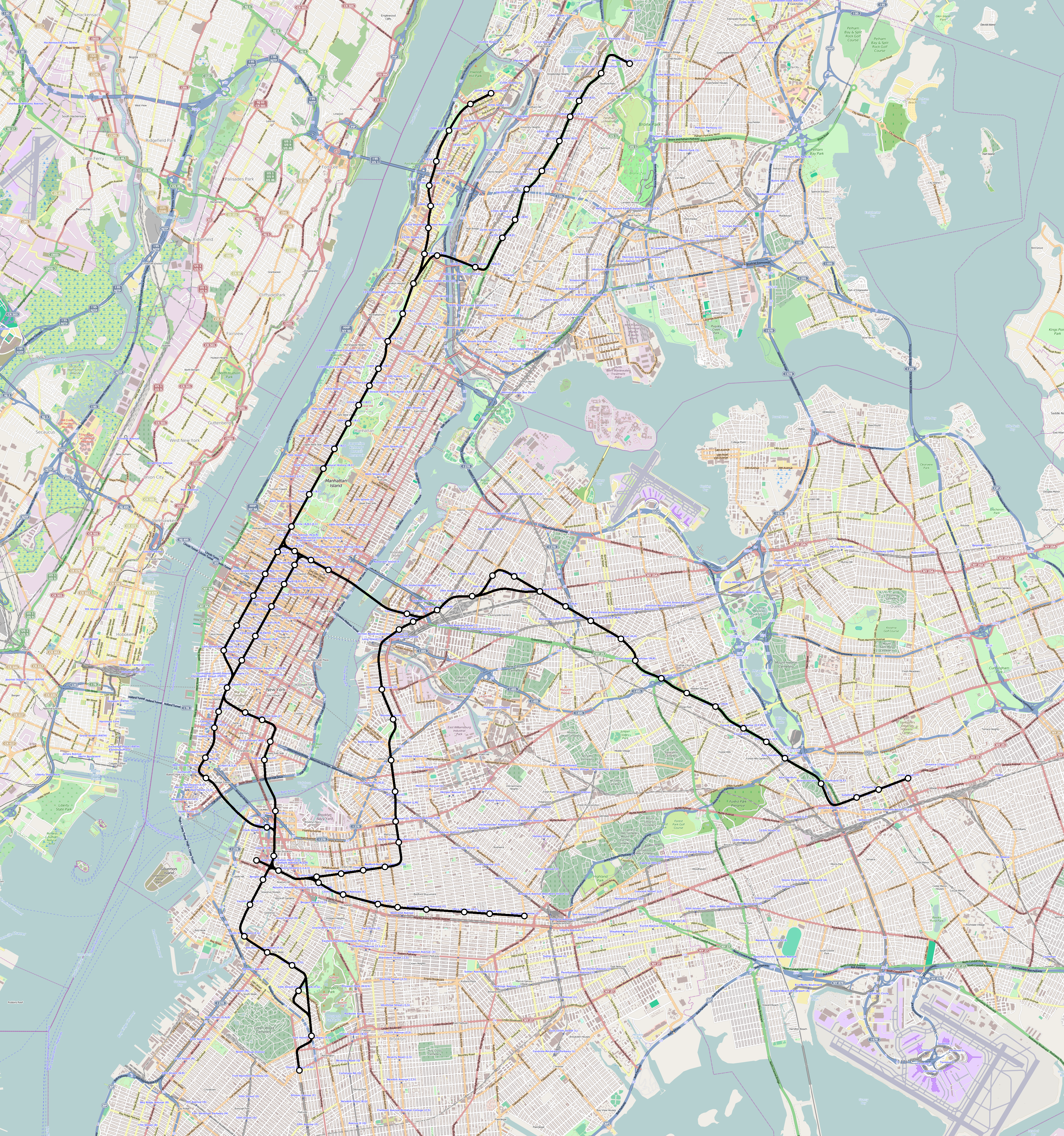
Italiano: Mappa dell'Independent Subway System nel 1940
English: Independent Subway System map in 1940 |
| Date | |
| Source | Own work, Background map from Openstreetmap (http://www.openstreetmap.org) |
| Author | L9A8M |
| Permission (Reusing this file) |
CC-BY-SA-3.0. |
Licensing
[edit]
This file is licensed under the Creative Commons Attribution-Share Alike 3.0 Unported license.
- You are free:
- to share – to copy, distribute and transmit the work
- to remix – to adapt the work
- Under the following conditions:
- attribution – You must give appropriate credit, provide a link to the license, and indicate if changes were made. You may do so in any reasonable manner, but not in any way that suggests the licensor endorses you or your use.
- share alike – If you remix, transform, or build upon the material, you must distribute your contributions under the same or compatible license as the original.
Original upload log
[edit]
The original description page was here. All following user names refer to it.wikipedia.
| Date/Time | Dimensions | User | Comment |
|---|---|---|---|
| 2017-05-20 19:07 | 3769×4025× (20409778 bytes) | L9A8M | Piccoli aggiustamenti |
| 2015-01-28 21:50 | 3769×4025× (21203090 bytes) | L9A8M | {{Informazioni file |Descrizione = Mappa dell'Independent Subway System. |Fonte = Opera propria, Background map from Openstreetmap ([http://www.openstreetmap.org/#map=0/-90/-130 http://www.openstreetmap.org]) |Data = 28 gennaio 2015 |Autore = [[Utente... |
File history
Click on a date/time to view the file as it appeared at that time.
| Date/Time | Thumbnail | Dimensions | User | Comment | |
|---|---|---|---|---|---|
| current | 19:10, 20 May 2017 | | 3,769 × 4,025 (19.46 MB) | L9A8M (talk | contribs) | == {{int:filedesc}} == {{Information |Description={{it|Mappa dell'Independent Subway System nel 1940}} {{en|Independent Subway System map in 1940}} |Source={{own}}, Background map from Openstreetmap ([http://www.openstreetmap.org/#map=0/-90/-130 http:/... |
You cannot overwrite this file.
File usage on Commons
The following 4 pages use this file:
File usage on other wikis
The following other wikis use this file:
- Usage on de.wikipedia.org
- Usage on it.wikipedia.org
- Usage on nl.wikipedia.org