File:Mapa linii kolejowej Stargard - Poznań 1847 r..jpg
Jump to navigation
Jump to search

Size of this preview: 799 × 184 pixels. Other resolutions: 320 × 74 pixels | 640 × 148 pixels | 1,024 × 236 pixels | 1,280 × 295 pixels | 2,560 × 590 pixels | 11,905 × 2,745 pixels.
Original file (11,905 × 2,745 pixels, file size: 11 MB, MIME type: image/jpeg)
Captions
Captions
Add a one-line explanation of what this file represents
Summary
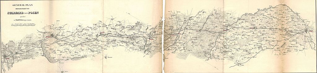
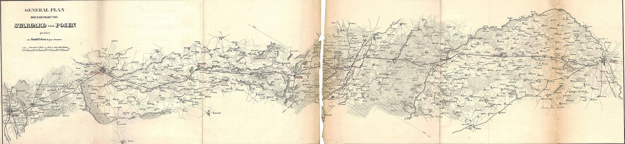
[edit]| Mapa linii kolejowej Stargard - Poznań w jednostce akta miasta Poznania za lata 1842-1847.
( |
||||||||||||||||||||||||
|---|---|---|---|---|---|---|---|---|---|---|---|---|---|---|---|---|---|---|---|---|---|---|---|---|
| Author |
Anonymous |
|||||||||||||||||||||||
| Title |
Mapa linii kolejowej Stargard - Poznań w jednostce akta miasta Poznania za lata 1842-1847. |
|||||||||||||||||||||||
| Description |
Pierwszy pociąg odjechał ze stacji 10 sierpnia 1848 r. |
|||||||||||||||||||||||
| Date | between 1842 and 1847 | |||||||||||||||||||||||
| Medium | paper | |||||||||||||||||||||||
| Collection |
|
|||||||||||||||||||||||
| Accession number |
53/474/0/10.6/4771 |
|||||||||||||||||||||||
| Source/Photographer |
|
|||||||||||||||||||||||
._Ysbail.jpg)
Licensing
[edit]
| This file is made available under the Creative Commons CC0 1.0 Universal Public Domain Dedication. | |
| The person who associated a work with this deed has dedicated the work to the public domain by waiving all of their rights to the work worldwide under copyright law, including all related and neighboring rights, to the extent allowed by law. You can copy, modify, distribute and perform the work, even for commercial purposes, all without asking permission.
|
File history
Click on a date/time to view the file as it appeared at that time.
| Date/Time | Thumbnail | Dimensions | User | Comment | |
|---|---|---|---|---|---|
| current | 05:50, 31 July 2015 | 11,905 × 2,745 (11 MB) | Crashzeroo (talk | contribs) | VicuñaUploader 1.20 |
You cannot overwrite this file.
File usage on Commons
The following 2 pages use this file:
File usage on other wikis
The following other wikis use this file:
- Usage on pl.wikipedia.org