File:Mapa geológico de España y Portugal, por el ingeniero de minas D. Federico de Botella y de Hornos.jpg
Original file (990 × 817 pixels, file size: 189 KB, MIME type: image/jpeg)
Captions
Captions
Summary[edit]
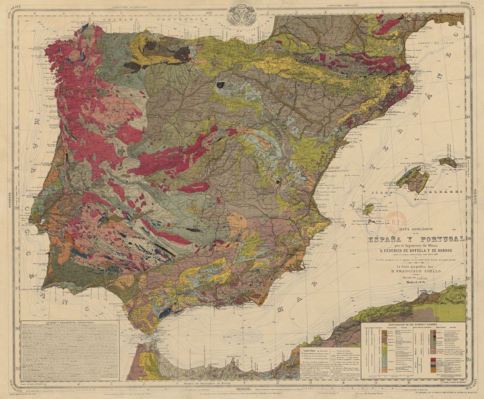
| Description | Mapa geológico de España y Portugal, por el ingeniero de minas D. Federico de Botella y de Hornos, escala 1:2 000 000. | ||||||||||||||||||||||||||||||||||||
| Date | |||||||||||||||||||||||||||||||||||||
| Source | Mapa geológico de España y Portugal. Gallica. | ||||||||||||||||||||||||||||||||||||
| Author |
|
||||||||||||||||||||||||||||||||||||
| Permission (Reusing this file) |
|
||||||||||||||||||||||||||||||||||||


File history
Click on a date/time to view the file as it appeared at that time.
| Date/Time | Thumbnail | Dimensions | User | Comment | |
|---|---|---|---|---|---|
| current | 18:28, 30 July 2015 | | 990 × 817 (189 KB) | Strakhov (talk | contribs) | Category:1848 in Spain {{Information |Description=''Mapa geológico de España y Portugal, por el ingeniero de minas D. Federico de Botella y de Hornos'', escala 1:2 000 000. |Source= {{cite web|author=[[:es:Biblioteca Digital Hispánica|Biblioteca... |
You cannot overwrite this file.
File usage on Commons
There are no pages that use this file.
File usage on other wikis
The following other wikis use this file:
- Usage on ca.wikipedia.org
- Usage on es.wikipedia.org