File:Mapa del archipiélago Chinijo.svg

Original file (SVG file, nominally 1,052 × 744 pixels, file size: 5.48 MB)
Captions
Captions
Summary[edit]
| Description |
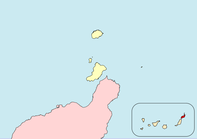
Español: Archipiélago Chinijo (Lanzarote, Canarias, España)
English:Chinijo-Archipel (Lanzarote, Canary Islands, Spain) |
| Date |
|
| Source |
Own work |
| Author |
Iván Hernández Cazorla |
|date=2016-05-13 |source=Own work a partir de:
- Instituto Geográfico Nacional. BCN 200 (Base de datos en línea). Centro de Descargas del Centro Nacional de Información Geográfica. Retrieved on 2016-05-13.
- Gobierno de Canarias (2006-09-21). BOC - 2006/185. Jueves 21 de Septiembre de 2006 - 1278 (Institucional). Boletín Oficial de Canarias. Retrieved on 2016-05-18.
|author=Iván Hernández Cazorla
|other fields=SVG development
}}
| Camera location | | View this and other nearby images on: OpenStreetMap |
|---|
Licensing[edit]
I, Iván Hernández Cazorla, have published this work under the terms of the license CC BY-SA 4.0, which allow you use and share this work, and create derivative works; under the condition of give me credit of the work using the same license. For that, please, add legibly:
Use this work in compliance with the terms of the license! If you use this work outside of the Wikimedia Projects, you can contact with me sending an email to |
|
This file is copyrighted and has been released under a license which is incompatible with Facebook's licensing terms. It is not permitted to upload this file to Facebook. |
- You are free:
- to share – to copy, distribute and transmit the work
- to remix – to adapt the work
- Under the following conditions:
- attribution – You must give appropriate credit, provide a link to the license, and indicate if changes were made. You may do so in any reasonable manner, but not in any way that suggests the licensor endorses you or your use.
- share alike – If you remix, transform, or build upon the material, you must distribute your contributions under the same or compatible license as the original.
File history
Click on a date/time to view the file as it appeared at that time.
| Date/Time | Thumbnail | Dimensions | User | Comment | |
|---|---|---|---|---|---|
| current | 18:27, 18 May 2016 | | 1,052 × 744 (5.48 MB) | Ivanhercaz (talk | contribs) | Revierto a la versión del 13 de mayo de 2016 a las 16:50 16:50, 13 May 2016 (UTC) para que el contenido del mapa esté acorde a su función. Aparte, subiré otro mapa con la delimitación del Parque Natural. |
| 01:00, 18 May 2016 |  | 1,052 × 744 (4.23 MB) | Ivanhercaz (talk | contribs) | Eliminación de etiqueta <flowRoot> en el cuadro de la comunidad autónoma: solución al recuadro negro en la esquina superior-izquierda. | |
| 00:42, 18 May 2016 |  | 1,052 × 744 (4.24 MB) | Ivanhercaz (talk | contribs) | Añado una leyenda mínima y necesaria para entender la zona resaltada del mapa. | |
| 00:05, 18 May 2016 |  | 1,052 × 744 (4.41 MB) | Ivanhercaz (talk | contribs) | Establezco los límites correctos del archipiélago Chinijo según el BOC 2006/185 1278. | |
| 16:50, 13 May 2016 |  | 1,052 × 744 (5.48 MB) | Ivanhercaz (talk | contribs) | Un trazo más fino en el cuadro de localización de Canarias. | |
| 14:48, 13 May 2016 |  | 1,052 × 744 (5.46 MB) | Ivanhercaz (talk | contribs) | User created page with UploadWizard |
You cannot overwrite this file.
File usage on Commons
The following 2 pages use this file:
File usage on other wikis
The following other wikis use this file:
- Usage on an.wikipedia.org
- Usage on es.wikipedia.org
- Usage on nl.wikivoyage.org
- Usage on ru.wikipedia.org
- Usage on zh.wikipedia.org