File:Mapa das grandes concentrações urbanas do Brasil.svg
Jump to navigation
Jump to search

Size of this PNG preview of this SVG file: 681 × 600 pixels. Other resolutions: 273 × 240 pixels | 545 × 480 pixels | 872 × 768 pixels | 1,163 × 1,024 pixels | 2,325 × 2,048 pixels | 780 × 687 pixels.
Original file (SVG file, nominally 780 × 687 pixels, file size: 541 KB)
Captions
Captions
Add a one-line explanation of what this file represents
| Description |
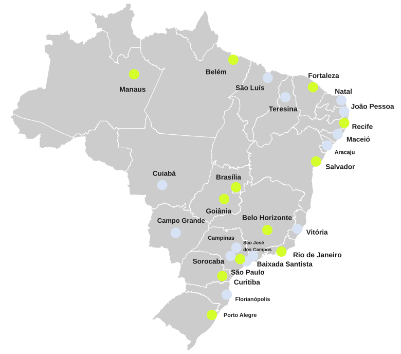
Português: Mapa das grandes concentrações urbanas do Brasil diferenciadas pela posição na hierarquia urbana brasileira (verde para metrópoles e azul para capitais regionais). |
||
| Date | |||
| Source |
This file was derived from: Capitais do Brasil por renda per capita.svg |
||
| Author |
by Luan |
||
| Permission (Reusing this file) |
Luan, the copyright holder of this work, hereby publishes it under the following license: This file is licensed under the Creative Commons Attribution-Share Alike 3.0 Brazil license. Attribution: Luan

|
||
| Other versions | Derivative works of this file: Mapa dos sistemas ferroviários urbanos do Brasil.svg |

File history
Click on a date/time to view the file as it appeared at that time.
| Date/Time | Thumbnail | Dimensions | User | Comment | |
|---|---|---|---|---|---|
| current | 23:26, 9 November 2016 | | 780 × 687 (541 KB) | Luan (talk | contribs) | {{subst:user:luan/byme |Description={{pt|Mapa das grandes concentrações urbanas do Brasil diferenciadas pela posição na [[:pt:Hierarquia urbana do Brasil|hierarquia urbana brasileir... |
You cannot overwrite this file.
File usage on Commons
The following page uses this file:
File usage on other wikis
The following other wikis use this file:
- Usage on pl.wikipedia.org
- Usage on pt.wikipedia.org
- Usage on www.wikidata.org