File:Mapa Wielkiego Księstwa Poznańskiego 1820.jpg
Jump to navigation
Jump to search
Size of this preview: 461 × 600 pixels. Other resolutions: 184 × 240 pixels | 369 × 480 pixels | 590 × 768 pixels | 787 × 1,024 pixels | 1,299 × 1,690 pixels.
Original file (1,299 × 1,690 pixels, file size: 814 KB, MIME type: image/jpeg)
Captions
Captions
Add a one-line explanation of what this file represents
Summary
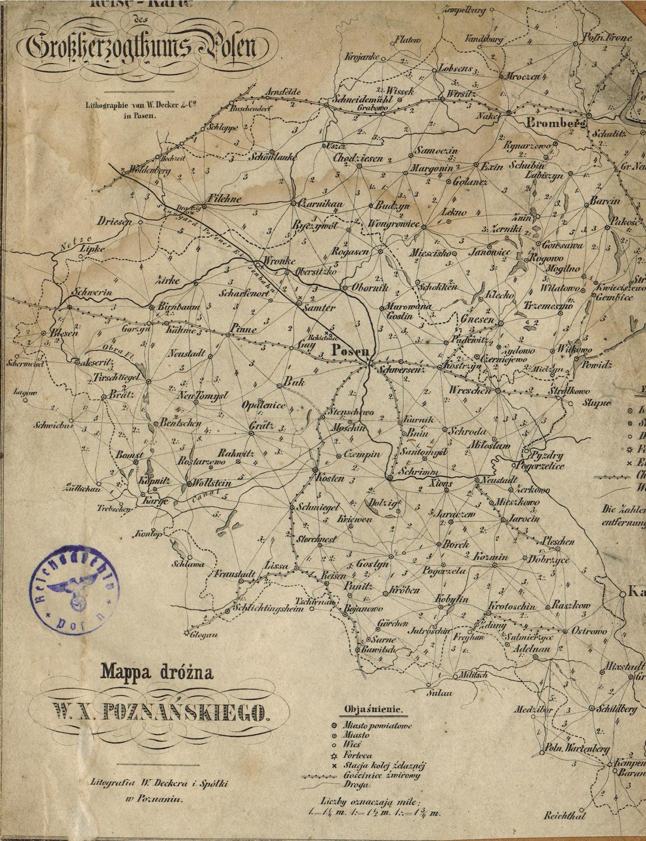
[edit]| Mappa dróżna Wielkiego Księstwa Poznańskiego
( |
||||||||||||||||||||||||
|---|---|---|---|---|---|---|---|---|---|---|---|---|---|---|---|---|---|---|---|---|---|---|---|---|
| Author |
|
|||||||||||||||||||||||
| Title |
Mappa dróżna Wielkiego Księstwa Poznańskiego |
|||||||||||||||||||||||
| Description |
Reise - Karte des Grossherzogthums Posen |
|||||||||||||||||||||||
| Date | circa 1820-1900 | |||||||||||||||||||||||
| Medium | paper | |||||||||||||||||||||||
| Dimensions | height: 19 cm (7.4 in); width: 15 cm (5.9 in) | |||||||||||||||||||||||
| Collection |
|
|||||||||||||||||||||||
| Accession number |
53/992/0/3/M.w. 37 |
|||||||||||||||||||||||
| Place of creation | Poznań | |||||||||||||||||||||||
| Notes |
Polski: skala: 1:420000 |
|||||||||||||||||||||||
| Source/Photographer |
|
|||||||||||||||||||||||

._Ysbail.jpg)
Licensing
[edit]
| This file is made available under the Creative Commons CC0 1.0 Universal Public Domain Dedication. | |
| The person who associated a work with this deed has dedicated the work to the public domain by waiving all of their rights to the work worldwide under copyright law, including all related and neighboring rights, to the extent allowed by law. You can copy, modify, distribute and perform the work, even for commercial purposes, all without asking permission.
|
File history
Click on a date/time to view the file as it appeared at that time.
| Date/Time | Thumbnail | Dimensions | User | Comment | |
|---|---|---|---|---|---|
| current | 09:39, 20 November 2014 | | 1,299 × 1,690 (814 KB) | Crashzeroo (talk | contribs) | VicuñaUploader 1.20 |
You cannot overwrite this file.
File usage on Commons
The following 2 pages use this file:
File usage on other wikis
The following other wikis use this file:
- Usage on bg.wikipedia.org
- Usage on pl.wikipedia.org
- Usage on ru.wikipedia.org