File:Mapa RMSalvador evolução territorial.svg
Jump to navigation
Jump to search

Size of this PNG preview of this SVG file: 800 × 404 pixels. Other resolutions: 320 × 162 pixels | 640 × 323 pixels | 1,024 × 517 pixels | 1,280 × 646 pixels | 2,560 × 1,293 pixels | 1,000 × 505 pixels.
Original file (SVG file, nominally 1,000 × 505 pixels, file size: 80 KB)
Captions
Captions
Add a one-line explanation of what this file represents
Summary[edit]
| Description |
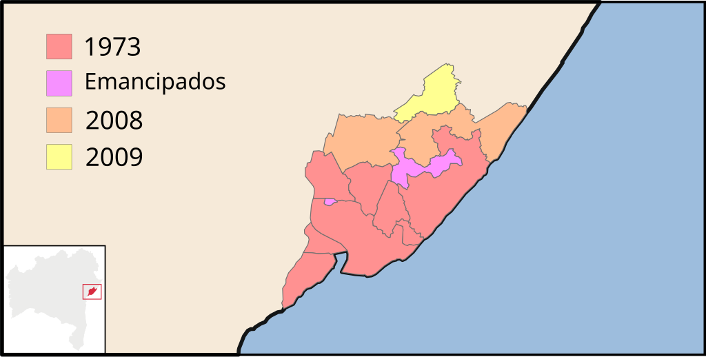
Português: Mapa da evolução territorial da Região Metropolitana de Salvador. Vermelho: municípios originais, Rosa: municípios desmembrados, Laranja: anexados em 2008, Amarelo: anexado em 2009. |
| Date | (UTC) |
| Source |
This file was derived from: Bahia RM Salvador.svg:  |
| Author |
|
| This is a retouched picture, which means that it has been digitally altered from its original version. The original can be viewed here: Bahia RM Salvador.svg:
|
Licensing[edit]
This file is licensed under the Creative Commons Attribution-Share Alike 3.0 Unported license.
- You are free:
- to share – to copy, distribute and transmit the work
- to remix – to adapt the work
- Under the following conditions:
- attribution – You must give appropriate credit, provide a link to the license, and indicate if changes were made. You may do so in any reasonable manner, but not in any way that suggests the licensor endorses you or your use.
- share alike – If you remix, transform, or build upon the material, you must distribute your contributions under the same or compatible license as the original.
Original upload log[edit]
This image is a derivative work of the following images:
- File:Bahia_RM_Salvador.svg licensed with Cc-by-2.5, Cc-by-sa-3.0-migrated, GFDL
- 2009-09-07T01:07:58Z Luan 886x918 (501762 Bytes) Incluí o município de [[:pt:Pojuca|]] ([[:s:pt:Lei complementar estadual da Bahia 32 de 2009]])
- 2008-02-24T04:16:44Z Luan 886x918 (501738 Bytes) Incluindo os municípios de São Sebastião do Passé e Mata de São João "recém-entrados"
- 2006-12-02T01:10:20Z Kensuke 886x918 (501614 Bytes) {{Information| |Description=Map locator of the Metropolitan Region of Salvador, BA |Source=[[:Image:Bahia MesoMicroMunicip.svg]], by [[User:Raphael.lorenzeto]] |Date=December, 1 2006 |Author=Pedro Cardoso de Carvalho e Freita
Uploaded with derivativeFX
File history
Click on a date/time to view the file as it appeared at that time.
| Date/Time | Thumbnail | Dimensions | User | Comment | |
|---|---|---|---|---|---|
| current | 00:18, 24 July 2012 | | 1,000 × 505 (80 KB) | Luan (talk | contribs) | legenda |
| 02:38, 22 July 2012 |  | 1,000 × 505 (77 KB) | Luan (talk | contribs) | == {{int:filedesc}} == {{Information |Description={{pt|Mapa da evolução territorial da pt:Região Metropolitana de Salvador. Vermelho: municípios originais, Rosa: municípios desmembrados, Laranja: anexados em 2008, Amarelo: anexado em 2009.}}... |
You cannot overwrite this file.
File usage on Commons
There are no pages that use this file.
File usage on other wikis
The following other wikis use this file:
- Usage on pt.wikipedia.org