File:Mapa, Dolnoslezské vojvodství západ.png
Jump to navigation
Jump to search

Size of this preview: 800 × 420 pixels. Other resolutions: 320 × 168 pixels | 640 × 336 pixels | 1,207 × 634 pixels.
Original file (1,207 × 634 pixels, file size: 695 KB, MIME type: image/png)
Captions
Captions
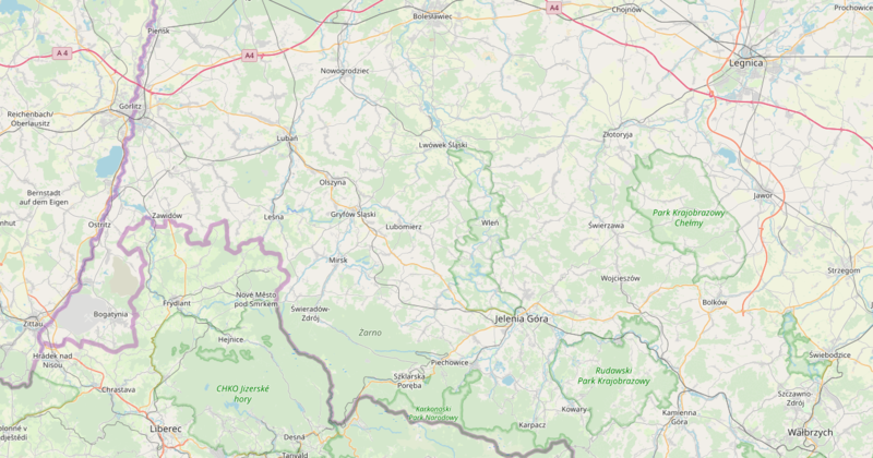
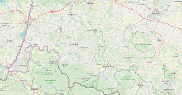
The map of the Lower Silesian Voivodeship
Summary[edit]
| Description |
Čeština: Screenshot Open Street Mapy západní části Dolnoslezského vojvodství - Polsko. English: OpenStreetMap screenshot of the western part of the Lower Silesian Voivodeship, Poland. |
|||
| Date | ||||
| Source | openstreetmap.org | |||
| Creator |
OpenStreetMap Contrubutors, Juandev (screenshot) OpenStreetMap contributors |
|||
| Permission (Reusing this file) |
OpenStreetMap data is available under the Open Database License (details). Map tiles are licensed under the Creative Commons Attribution-ShareAlike 2.0 license (CC-BY-SA 2.0).
This file is licensed under the Creative Commons Attribution-Share Alike 2.0 Generic license.
|
|||
| Georeferencing | If inappropriate please set warp_status = skip to hide. |
File history
Click on a date/time to view the file as it appeared at that time.
| Date/Time | Thumbnail | Dimensions | User | Comment | |
|---|---|---|---|---|---|
| current | 21:26, 9 February 2020 | | 1,207 × 634 (695 KB) | Juandev (talk | contribs) | User created page with UploadWizard |
You cannot overwrite this file.
File usage on Commons
There are no pages that use this file.
File usage on other wikis
The following other wikis use this file:
- Usage on cs.wikipedia.org
- Usage on pl.wikimedia.org