File:Map of the World (1935).png
Jump to navigation
Jump to search

Size of this preview: 800 × 405 pixels. Other resolutions: 320 × 162 pixels | 640 × 324 pixels | 1,024 × 519 pixels | 1,280 × 648 pixels | 2,560 × 1,296 pixels | 4,974 × 2,519 pixels.
Original file (4,974 × 2,519 pixels, file size: 325 KB, MIME type: image/png)
Captions
Captions
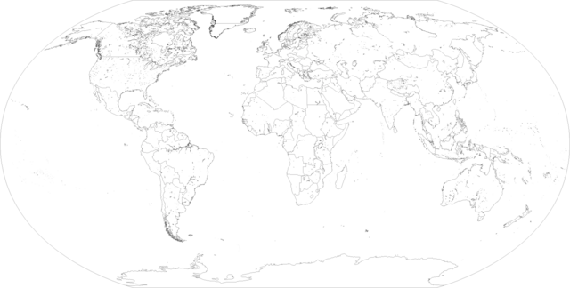
A detailed map of the world as it appeared in 1935.
Summary
[edit].png&action=edit§ion=1)
| Description |
English: A detailed map of the world as it appeared in 1935, based on Geography and Space's version with various fixes to be as accurate as possible. |
| Date | |
| Source | Geography and Space |
| Author | Shadowboxer2005 |
| Flag maps of the world for historical use | |
|
20th Century | |
|
21st Century | |
| (this template: • view • discuss ) | |
.png)
-1.png)
.png&action=edit&redlink=1)
.png&action=edit&redlink=1)
.png&action=edit&redlink=1)
Licensing
[edit].png&action=edit§ion=2)
This file is licensed under the Creative Commons Attribution-Share Alike 4.0 International license.
- You are free:
- to share – to copy, distribute and transmit the work
- to remix – to adapt the work
- Under the following conditions:
- attribution – You must give appropriate credit, provide a link to the license, and indicate if changes were made. You may do so in any reasonable manner, but not in any way that suggests the licensor endorses you or your use.
- share alike – If you remix, transform, or build upon the material, you must distribute your contributions under the same or compatible license as the original.
File history
Click on a date/time to view the file as it appeared at that time.
| Date/Time | Thumbnail | Dimensions | User | Comment | |
|---|---|---|---|---|---|
| current | 01:11, 1 May 2024 | | 4,974 × 2,519 (325 KB) | Shadowboxer2005 (talk | contribs) | Fixed Jordan's borders |
| 23:49, 10 September 2023 |  | 4,974 × 2,519 (325 KB) | Shadowboxer2005 (talk | contribs) | Fixed remaining border errors | |
| 07:02, 22 August 2023 |  | 4,974 × 2,519 (325 KB) | Shadowboxer2005 (talk | contribs) | Corrected Mongolia's borders | |
| 23:14, 11 August 2023 |  | 4,974 × 2,519 (325 KB) | Shadowboxer2005 (talk | contribs) | Fixed a single missing pixel in French West Africa | |
| 11:22, 11 August 2023 |  | 4,974 × 2,519 (325 KB) | Shadowboxer2005 (talk | contribs) | PROPERLY removed Kiautchou and Weihai from the map (had already been returned to China). | |
| 11:42, 4 July 2023 |  | 4,974 × 2,519 (325 KB) | Shadowboxer2005 (talk | contribs) | Reverted to version as of 23:33, 28 June 2023 (UTC) | |
| 11:41, 4 July 2023 |  | 4,974 × 2,519 (342 KB) | Shadowboxer2005 (talk | contribs) | Removed Kiautchou and Weihai from the map (had already been returned to China). | |
| 23:33, 28 June 2023 |  | 4,974 × 2,519 (325 KB) | Shadowboxer2005 (talk | contribs) | Added the League of Nation mandates for Togoland and South West Africa | |
| 23:14, 28 June 2023 |  | 4,974 × 2,519 (325 KB) | Shadowboxer2005 (talk | contribs) | Uploaded a work by Shadowboxer2005 from [https://www.youtube.com/channel/UCmjvfHgVn6h6j9gWqiVEAVg/featured Geography and Space] with UploadWizard |
You cannot overwrite this file.
File usage on Commons
There are no pages that use this file.
.png&oldid=872690858)