File:Map of the Colony of Rhode Island giving the Indian names of locations.jpg
Jump to navigation
Jump to search

Size of this preview: 447 × 599 pixels. Other resolutions: 179 × 240 pixels | 358 × 480 pixels | 573 × 768 pixels | 764 × 1,024 pixels | 1,528 × 2,048 pixels | 8,418 × 11,284 pixels.
Original file (8,418 × 11,284 pixels, file size: 37.12 MB, MIME type: image/jpeg)
Captions
Captions
Add a one-line explanation of what this file represents
Summary
[edit]
| Warning | The original file is very high-resolution. It might not load properly or could cause your browser to freeze when opened at full size. |
|---|
| Description |
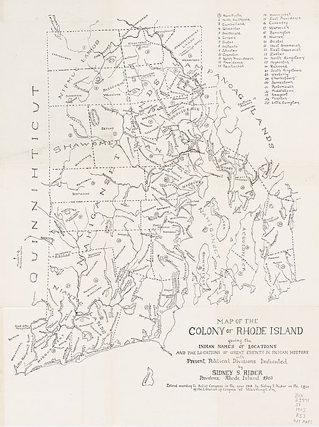
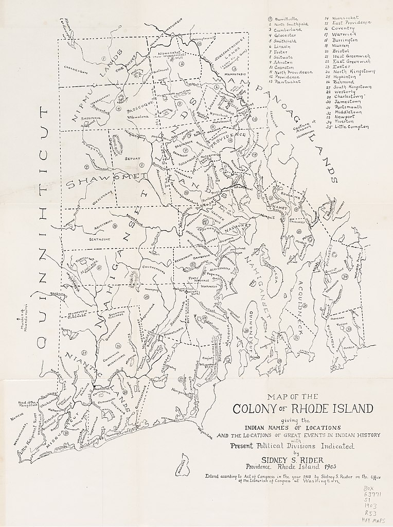
English: "Map of the Colony of Rhode Island: giving the Indian names of locations and the locations of great events in Indian history with present political divisions indicated"
Additionally published in "The lands of Rhode Island : as they were known to Caunounicus and Miantunnomu when Roger Williams came in 1636 : an Indian map of the principal locations known to the Nahigansets, and elaborate historical notes" [1] |
| Date | |
| Source | https://repository.library.brown.edu/studio/item/bdr:42020/ |
| Author | Sidney Smith Rider (1833-1917) |
Licensing
[edit]
|
This work is in the public domain in its country of origin and other countries and areas where the copyright term is the author's life plus 70 years or fewer. This work is in the public domain in the United States because it was published (or registered with the U.S. Copyright Office) before January 1, 1929. | |
| This file has been identified as being free of known restrictions under copyright law, including all related and neighboring rights. | |
File history
Click on a date/time to view the file as it appeared at that time.
| Date/Time | Thumbnail | Dimensions | User | Comment | |
|---|---|---|---|---|---|
| current | 19:12, 17 May 2020 | | 8,418 × 11,284 (37.12 MB) | Filetime (talk | contribs) | Uploaded a work by Sidney Smith Rider (1833-1917) from https://repository.library.brown.edu/studio/item/bdr:42020/ with UploadWizard |
You cannot overwrite this file.
File usage on Commons
There are no pages that use this file.