File:Map of Utah highlighting Utah County.svg
Jump to navigation
Jump to search

Size of this PNG preview of this SVG file: 480 × 599 pixels. Other resolutions: 192 × 240 pixels | 384 × 480 pixels | 615 × 768 pixels | 820 × 1,024 pixels | 1,640 × 2,048 pixels | 4,457 × 5,566 pixels.
Original file (SVG file, nominally 4,457 × 5,566 pixels, file size: 50 KB)
Captions
Captions
Add a one-line explanation of what this file represents
Summary[edit]
| Description |
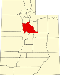
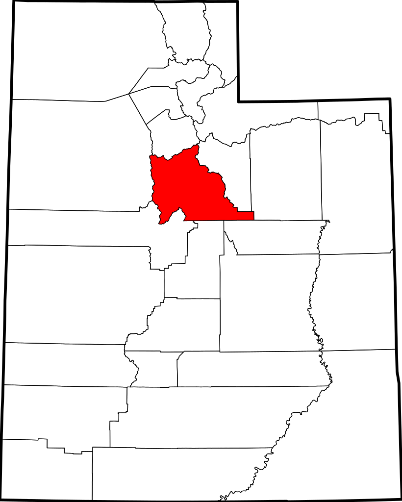
English: This is a locator map showing Utah County in Utah. For more information, see Commons:United States county locator maps. |
| Date | |
| Source |
Own work: English: The maps use data from nationalatlas.gov, specifically countyp020.tar.gz on the Raw Data Download page. The maps also use state outline data from statesp020.tar.gz. The Florida maps use hydrogm020.tar.gz to display Lake Okeechobee. |
| Author | David Benbennick |
| SVG development | This W3C-invalid locator map was created with an unknown SVG tool. |
Licensing[edit]
| I, the copyright holder of this work, release this work into the public domain. This applies worldwide. In some countries this may not be legally possible; if so: I grant anyone the right to use this work for any purpose, without any conditions, unless such conditions are required by law. |
File history
Click on a date/time to view the file as it appeared at that time.
| Date/Time | Thumbnail | Dimensions | User | Comment | |
|---|---|---|---|---|---|
| current | 05:04, 24 November 2020 | | 4,457 × 5,566 (50 KB) | 4nn1l2 (talk | contribs) | Special:diff/514604312 |
| 17:36, 12 February 2006 |  | 4,457 × 5,566 (56 KB) | David Benbennick (talk | contribs) | {{subst:User:Dbenbenn/clm|county=Utah County|state=Utah|type=county}} |
You cannot overwrite this file.
File usage on Commons
The following 9 pages use this file:
- Commons:Graphic Lab/Map workshop/Archive/2020
- Category:Births in Utah County, Utah
- Category:Deaths in Utah County, Utah
- Category:Education in Utah County, Utah
- Category:Geography of Utah County, Utah
- Category:Maps of Utah County, Utah
- Category:People of Utah County, Utah
- Category:Transport in Utah County, Utah
- Category:Utah County, Utah
File usage on other wikis
The following other wikis use this file:
- Usage on ar.wikipedia.org
- مقاطعة يوتا (يوتا)
- بروفو
- ثيستل (يوتا)
- سيدار فورت (يوتا)
- فيرفيلد (يوتا)
- غينولا (يوتا)
- غوشن (يوتا)
- فينيارد (يوتا)
- أوريم (يوتا)
- سبرينغفيل (يوتا)
- أمريكان فورك
- بايسون
- سبانيش فورك
- ألباين
- ليهي
- بليزانت غروف
- درابر
- سانتاكوين
- سيدار هيلز
- هايلاند (يوتا)
- ليندون (يوتا)
- مابلتون (يوتا)
- سالم (يوتا)
- إلك ريدج
- وودلاند هيلز (يوتا)
- بلوفديل
- ساراتوغا سبرينغز
- إيغل ماونتن
- قائمة مقاطعات يوتا
- سبرينغ لاك (يوتا)
- ويست ماونتين (يوتا)
- بنجامين (يوتا)
- قالب:مقاطعة يوتا (يوتا)
- إلبرتا (يوتا)
- لاك شور (يوتا)
- Usage on be.wikipedia.org
- Usage on bg.wikipedia.org
- Usage on bpy.wikipedia.org
- Usage on cdo.wikipedia.org
- Usage on ceb.wikipedia.org
- Usage on ce.wikipedia.org
- Usage on cs.wikipedia.org
- Usage on cy.wikipedia.org
- Usage on de.wikipedia.org
View more global usage of this file.