File:Map of Ukraine political Chemical indystry.png
Jump to navigation
Jump to search
No higher resolution available.
Map_of_Ukraine_political_Chemical_indystry.png (800 × 559 pixels, file size: 120 KB, MIME type: image/png)
Captions
Captions
Add a one-line explanation of what this file represents
Summary[edit]
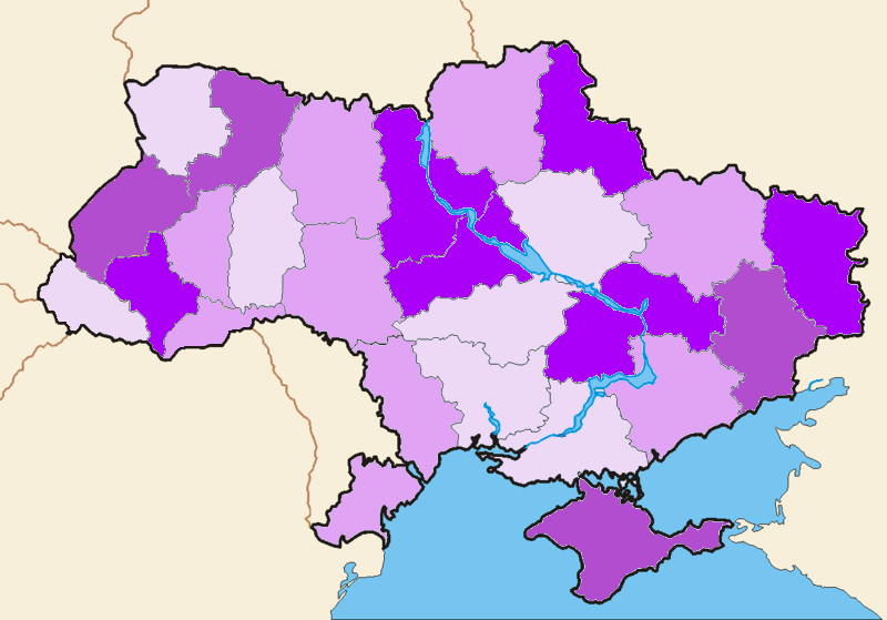
Хімічна промисловість України. Кольорами позначено рівень розвитку хімічної промисловості у різних областях України від темнішого до світлішого: Дуже високий, високий, середній, низький.
Для підготування мапи використовувалися матеріали Атласу України 2005 року.
Licensing[edit]
| I, the copyright holder of this work, release this work into the public domain. This applies worldwide. In some countries this may not be legally possible; if so: I grant anyone the right to use this work for any purpose, without any conditions, unless such conditions are required by law. |
File history
Click on a date/time to view the file as it appeared at that time.
| Date/Time | Thumbnail | Dimensions | User | Comment | |
|---|---|---|---|---|---|
| current | 09:30, 11 July 2007 | | 800 × 559 (120 KB) | MaryankoD (talk | contribs) | Хімічна промисловість України. Кольорами позначено рівень розвитку хімічної промисловості у різних областях України від темнішого до сві |
You cannot overwrite this file.
File usage on Commons
There are no pages that use this file.
File usage on other wikis
The following other wikis use this file:
- Usage on uk.wikipedia.org