File:Map of Piedmont Virginia LOC 2005625117.jpg
Jump to navigation
Jump to search
Size of this preview: 479 × 600 pixels. Other resolutions: 192 × 240 pixels | 383 × 480 pixels | 613 × 768 pixels | 818 × 1,024 pixels | 1,636 × 2,048 pixels | 3,044 × 3,810 pixels.
Original file (3,044 × 3,810 pixels, file size: 1.32 MB, MIME type: image/jpeg)
Captions
Captions
Add a one-line explanation of what this file represents
Summary[edit]
| Description |
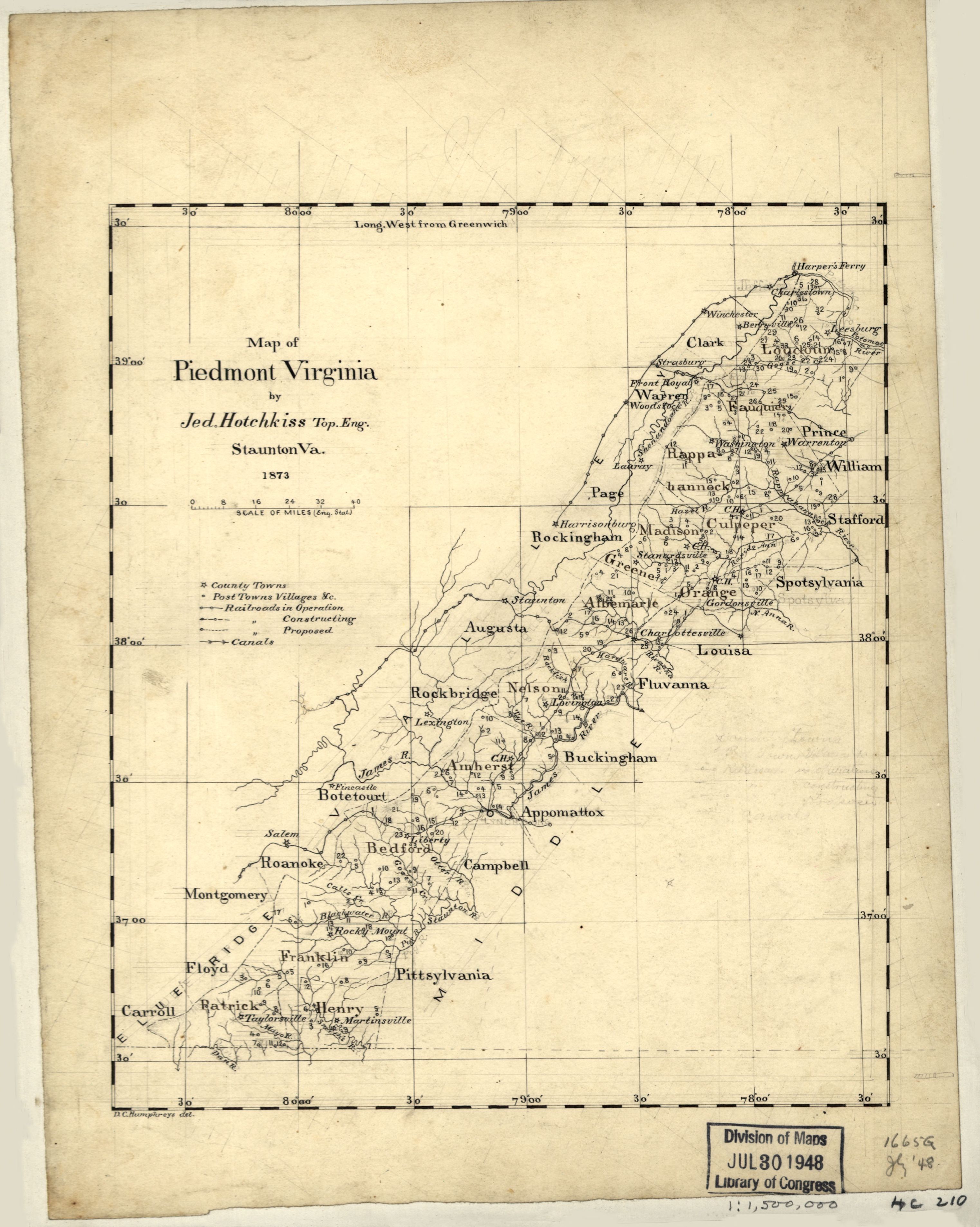
English: Shows area from southwest Loudoun County to Carroll County, Virginia. Relief shown by spot heights. Pen-and-ink and pencil, mounted on cloth. LC Civil War maps (2nd ed.), H210 In pencil on verso: 197. Available also through the Library of Congress web site as raster image. |
||
| Title | Map of Piedmont Virginia | ||
| Shelf ID | G3880 1873 .H6 | ||
| Date | |||
| Source | https://www.loc.gov/item/2005625117/ | ||
| Author | Hotchkiss, Jedediah; Humphreys, D. C. | ||
| Permission (Reusing this file) |
|
||
| Other versions |
|
||
| Location | Piedmont (Region) · United States · Region · Piedmont · Virginia | ||
| Part of | Military Battles And Campaigns · Hotchkiss Map Collection · Catalog · American Memory · Geography And Map Division | ||
| Subject | United States · Maps, Manuscript · Piedmont (Region) · Virginia · Piedmont (U.S. : Region) |

Licensing[edit]
|
This is a faithful photographic reproduction of a two-dimensional, public domain work of art. The work of art itself is in the public domain for the following reason:
The official position taken by the Wikimedia Foundation is that "faithful reproductions of two-dimensional public domain works of art are public domain".
This photographic reproduction is therefore also considered to be in the public domain in the United States. In other jurisdictions, re-use of this content may be restricted; see Reuse of PD-Art photographs for details. | ||||
File history
Click on a date/time to view the file as it appeared at that time.
| Date/Time | Thumbnail | Dimensions | User | Comment | |
|---|---|---|---|---|---|
| current | 19:27, 8 July 2018 | | 3,044 × 3,810 (1.32 MB) | Fæ (talk | contribs) | LOC Maps https://www.loc.gov/item/2005625117/ #362 |
You cannot overwrite this file.
File usage on Commons
The following page uses this file: