File:Map of Maryland highlighting Prince George's County.svg
Jump to navigation
Jump to search

Size of this PNG preview of this SVG file: 800 × 419 pixels. Other resolutions: 320 × 167 pixels | 640 × 335 pixels | 1,024 × 536 pixels | 1,280 × 670 pixels | 2,560 × 1,340 pixels | 3,858 × 2,019 pixels.
Original file (SVG file, nominally 3,858 × 2,019 pixels, file size: 139 KB)
Captions
Captions
Add a one-line explanation of what this file represents
Summary[edit]
| Description |
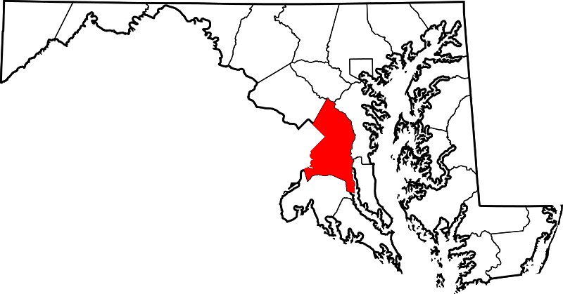
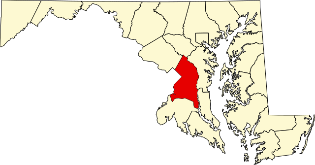
This is a locator map showing Prince George's County in Maryland. David Benbennick made this map. For more information, see Commons:United States county locator maps. |
| Date | 12 February 2006 (original upload date) |
| Source | No machine-readable source provided. Own work assumed (based on copyright claims). |
| Author | No machine-readable author provided. David Benbennick assumed (based on copyright claims). |
Licensing[edit]
| I, the copyright holder of this work, release this work into the public domain. This applies worldwide. In some countries this may not be legally possible; if so: I grant anyone the right to use this work for any purpose, without any conditions, unless such conditions are required by law. |
File history
Click on a date/time to view the file as it appeared at that time.
| Date/Time | Thumbnail | Dimensions | User | Comment | |
|---|---|---|---|---|---|
| current | 12:49, 12 February 2006 | | 3,858 × 2,019 (139 KB) | David Benbennick (talk | contribs) | {{subst:User:Dbenbenn/clm|county=Prince George's County|state=Maryland|type=county}} |
You cannot overwrite this file.
File usage on Commons
The following 14 pages use this file:
- Category:Births in Prince George's County, Maryland
- Category:Census-designated places in Prince George's County, Maryland
- Category:Churches in Prince George's County, Maryland
- Category:Deaths in Prince George's County, Maryland
- Category:Geography of Prince George's County, Maryland
- Category:Houses in Prince George's County, Maryland
- Category:Maps of Prince George's County, Maryland
- Category:National Register of Historic Places in Prince George's County, Maryland
- Category:People of Prince George's County, Maryland
- Category:Populated places in Prince George's County, Maryland
- Category:Prince George's County, Maryland
- Category:Roads in Prince George's County, Maryland
- Category:Schools in Prince George's County, Maryland
- Category:Unincorporated communities in Prince George's County, Maryland
File usage on other wikis
The following other wikis use this file:
- Usage on ar.wikipedia.org
- لوريل (ميريلاند)
- مقاطعة برينس جورج (ماريلاند)
- بروين هايتس (ماريلاند)
- بلادينسبورغ (ماريلاند)
- برنتوود (ماريلاند)
- كابيتول هايتس (ماريلاند)
- تشيفيرلي (ماريلاند)
- كولمار مانور (ماريلاند)
- كوتاغ سيتي (ماريلاند)
- إيغل هاربور (ماريلاند)
- إدمونستون (ماريلاند)
- فيرمونت هايتس (ماريلاند)
- فورست هايتس (ماريلاند)
- لاندوفر هيلز (ماريلاند)
- نورث برنتوود (ماريلاند)
- ريفرديل بارك (ماريلاند)
- يونيفرسيتي بارك (ماريلاند)
- أبر مارلبورو (ماريلاند)
- فانسفيل (ماريلاند)
- باوي (ماريلاند)
- كوليج بارك
- غرينبيلت
- هايتسفيل
- نيو كارولتون
- سيت بليزانت
- منطقة هايتس
- غليناردين
- ماونت رينيير
- قائمة مقاطعات ماريلاند
- لاندوفر (مريلاند)
- ساوث لوريل (ماريلند)
- لانغلي بارك (ماريلند)
- ووكر ميل (ماريلند)
- كامب سبرينغز (ماريلند)
- تمبل هيلز (ماريلند)
- كورال هيلز (ماريلند)
- إيست ريفرديل (ماريلند)
- ويست لوريل (ماريلند)
- فورستفيل (ماريلند)
- كلينتون (ماريلند)
- برانديواين (ماريلند)
- كيترينج (ماريلند)
- فريندلي (ماريلند)
- فورت واشنطن (ماريلند)
- غلين دالي (ماريلند)
- أدلفي (ماريلند)
- قالب:مقاطعة برينس جورج (ماريلاند)
- Usage on bpy.wikipedia.org
- Usage on ca.wikipedia.org
View more global usage of this file.