File:Map of Langhe inside Piedmont.svg
Jump to navigation
Jump to search

Size of this PNG preview of this SVG file: 460 × 599 pixels. Other resolutions: 184 × 240 pixels | 368 × 480 pixels | 589 × 768 pixels | 786 × 1,024 pixels | 1,572 × 2,048 pixels | 1,000 × 1,303 pixels.
Original file (SVG file, nominally 1,000 × 1,303 pixels, file size: 12.5 MB)
Captions
Captions
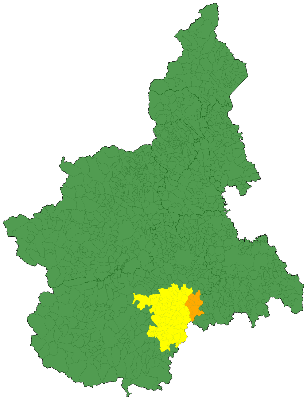
This is a map of Langhe territory inside Piedmont
Summary[edit]
| Description |
English: This is a map of Langhe territory inside Piedmont. The yellow part is from the province of Cuneo, while the orange part is from the province of Asti
Italiano: Cartina geografica delle Langhe all'interno della regione Piemonte. La zona gialla rappresenta le Langhe all'interno della provincia di Cuneo, la zona arancione dentro la provincia di Asti |
| Date | |
| Source | Own work |
| Author | Carlinga314 |
Licensing[edit]
I, the copyright holder of this work, hereby publish it under the following license:
| This file is made available under the Creative Commons CC0 1.0 Universal Public Domain Dedication. | |
| The person who associated a work with this deed has dedicated the work to the public domain by waiving all of their rights to the work worldwide under copyright law, including all related and neighboring rights, to the extent allowed by law. You can copy, modify, distribute and perform the work, even for commercial purposes, all without asking permission.
|
File history
Click on a date/time to view the file as it appeared at that time.
| Date/Time | Thumbnail | Dimensions | User | Comment | |
|---|---|---|---|---|---|
| current | 16:36, 4 May 2024 | | 1,000 × 1,303 (12.5 MB) | Carlinga314 (talk | contribs) | Uploaded own work with UploadWizard |
You cannot overwrite this file.
File usage on Commons
There are no pages that use this file.
File usage on other wikis
The following other wikis use this file:
- Usage on it.wikipedia.org