File:Map of French Flanders.png
Jump to navigation
Jump to search
Size of this preview: 483 × 599 pixels. Other resolutions: 193 × 240 pixels | 387 × 480 pixels | 722 × 896 pixels.
Original file (722 × 896 pixels, file size: 194 KB, MIME type: image/png)
Captions
Captions
Add a one-line explanation of what this file represents
Summary[edit]
| Description |
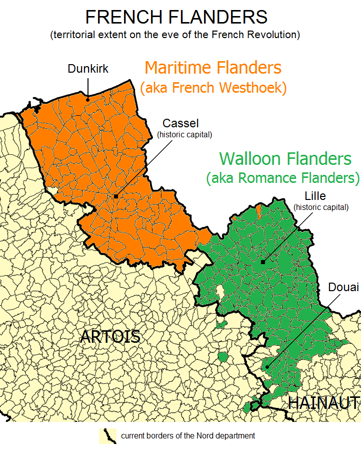
English: Map of the province of French Flanders with its borders on the eve of 1789, based on État par ordre alphabétique des Villes, Bourgs, Villages & hameaux de la Généralité de Flandres & d'Artois published in 1787. |
| Date | |
| Source | Own work |
| Author | Rosss |
Licensing[edit]
I, the copyright holder of this work, hereby publish it under the following license:
This file is licensed under the Creative Commons Attribution-Share Alike 3.0 Unported license.
- You are free:
- to share – to copy, distribute and transmit the work
- to remix – to adapt the work
- Under the following conditions:
- attribution – You must give appropriate credit, provide a link to the license, and indicate if changes were made. You may do so in any reasonable manner, but not in any way that suggests the licensor endorses you or your use.
- share alike – If you remix, transform, or build upon the material, you must distribute your contributions under the same or compatible license as the original.
File history
Click on a date/time to view the file as it appeared at that time.
| Date/Time | Thumbnail | Dimensions | User | Comment | |
|---|---|---|---|---|---|
| current | 01:06, 28 August 2011 | | 722 × 896 (194 KB) | Rosss (talk | contribs) | Translation |
| 01:02, 28 August 2011 |  | 722 × 896 (195 KB) | Rosss (talk | contribs) |
You cannot overwrite this file.
File usage on Commons
The following page uses this file:
File usage on other wikis
The following other wikis use this file:
- Usage on en.wikipedia.org
- Usage on eu.wikipedia.org
- Usage on he.wikipedia.org
- Usage on nl.wikipedia.org