File:Map of Efate Island.svg
Jump to navigation
Jump to search

Size of this PNG preview of this SVG file: 782 × 600 pixels. Other resolutions: 313 × 240 pixels | 626 × 480 pixels | 1,002 × 768 pixels | 1,280 × 981 pixels | 2,560 × 1,963 pixels | 3,900 × 2,990 pixels.
Original file (SVG file, nominally 3,900 × 2,990 pixels, file size: 455 KB)
Captions
Captions
Add a one-line explanation of what this file represents
Summary[edit]
| Description |
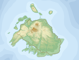
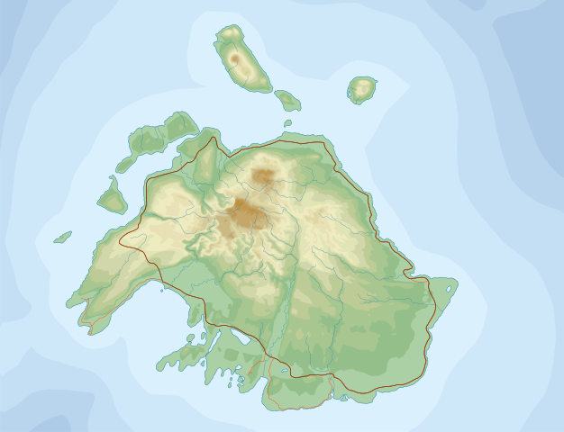
English: Topographic Map of Efate Island (Vanuatu)
|
| Date | 12.03.2008 |
| Source |
Own work.
Data sources :
Softwares used :
Others :
|
| Author | Переход Артур |
| Permission (Reusing this file) |
CC-BY-SA |

|
This SVG file contains embedded text that can be translated into your language, using any capable SVG editor, text editor or the SVG Translate tool. For more information see: About translating SVG files. |
This W3C-unspecified vector image was created with Inkscape .
Licensing[edit]
I, the copyright holder of this work, hereby publish it under the following license:
This file is licensed under the Creative Commons Attribution-Share Alike 3.0 Unported license.
- You are free:
- to share – to copy, distribute and transmit the work
- to remix – to adapt the work
- Under the following conditions:
- attribution – You must give appropriate credit, provide a link to the license, and indicate if changes were made. You may do so in any reasonable manner, but not in any way that suggests the licensor endorses you or your use.
- share alike – If you remix, transform, or build upon the material, you must distribute your contributions under the same or compatible license as the original.
File history
Click on a date/time to view the file as it appeared at that time.
| Date/Time | Thumbnail | Dimensions | User | Comment | |
|---|---|---|---|---|---|
| current | 17:58, 14 March 2008 | | 3,900 × 2,990 (455 KB) | Переход Артур (talk | contribs) | {{Information |Description={{en|Topographic Map of Efate Island (Vanuatu)}} {{ru|Топографическая карта острова Эфате (Республика Вануату)}} |Source=Own work.{{clr}} |
| 18:27, 13 March 2008 |  | 3,900 × 2,990 (436 KB) | Переход Артур (talk | contribs) | {{Information |Description={{en|Topographic Map of Efate Island (Vanuatu)}} {{ru|Топографическая карта острова Эфате (Республика Вануату)}} |Source=Own work.{{clr}} | |
| 20:55, 12 March 2008 |  | 3,900 × 2,990 (374 KB) | Переход Артур (talk | contribs) | {{Information |Description={{en|Topographic Map of Efate Island (Vanuatu)}} {{ru|Топографическая карта острова Эфате (Республика Вануату)}} |Source=Own work.{{clr}} | |
| 20:16, 12 March 2008 |  | 3,900 × 2,990 (348 KB) | Переход Артур (talk | contribs) | {{Information |Description={{en|Topographic Map of Efate Island (Vanuatu)}} {{ru|Топографическая карта острова Эфате (Республика Вануату)}} |Source=Own work.{{clr}} | |
| 18:56, 12 March 2008 |  | 4,000 × 3,200 (379 KB) | Переход Артур (talk | contribs) | {{Information |Description={{lang-en|Topographic Map of Efate Island (Vanuatu)}} {{lang-ru|Топографическая карта острова Эфате (Республика Вануату)}} |Source=Own wo |
You cannot overwrite this file.
File usage on Commons
The following 3 pages use this file: