File:Map of Athos.svg
Jump to navigation
Jump to search

Size of this PNG preview of this SVG file: 601 × 600 pixels. Other resolutions: 241 × 240 pixels | 481 × 480 pixels | 770 × 768 pixels | 1,026 × 1,024 pixels | 2,053 × 2,048 pixels | 2,490 × 2,484 pixels.
Original file (SVG file, nominally 2,490 × 2,484 pixels, file size: 4.39 MB)
Captions
Captions
Add a one-line explanation of what this file represents
Summary
[edit]
| Description |
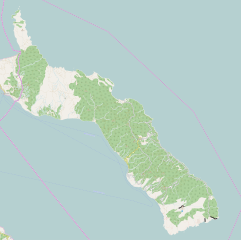
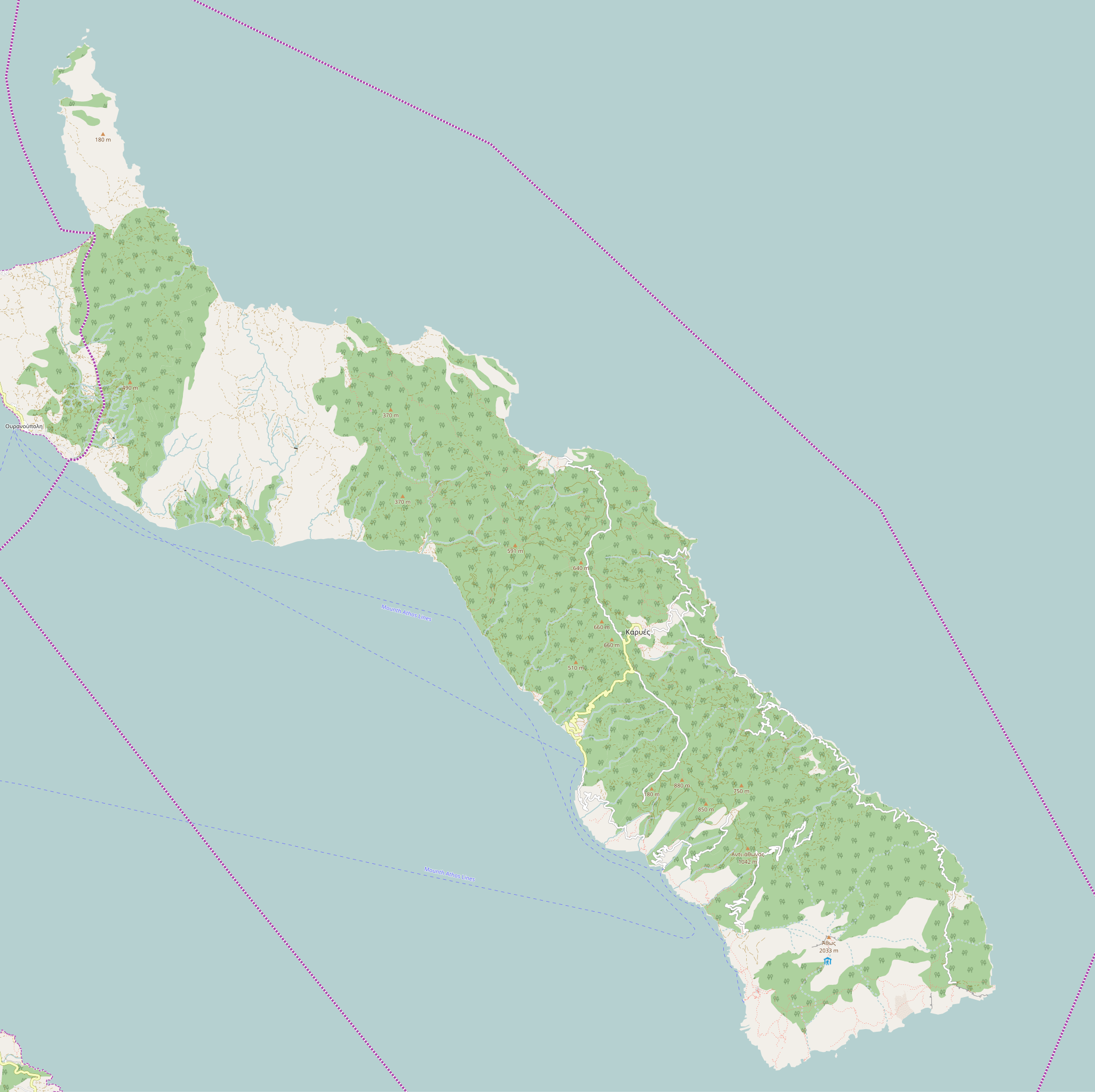
English: OpenStreetMap - Map of Athos
Български: Позиционна карата на Света гора
|
| Date | |
| Source | http://www.openstreetmap.org/ |
| Author | OpenStreetMap |
Licensing
[edit]
| This work contains information from OpenStreetMap, which is made available under the Open Database License (ODbL).
The ODbL does not require any particular license for maps produced from ODbL data. Prior to 1 August 2020, map tiles produced by the OpenStreetMap Foundation were licensed under the CC-BY-SA-2.0 license. Maps produced by other people may be subject to other licences. |
File history
Click on a date/time to view the file as it appeared at that time.
| Date/Time | Thumbnail | Dimensions | User | Comment | |
|---|---|---|---|---|---|
| current | 09:54, 28 December 2016 | | 2,490 × 2,484 (4.39 MB) | Rumensz (talk | contribs) | {{Information |Description ={{en|1=OpenStreetMap - Map of Athos}} {{bg|1=Позиционна карата на Света гора}} |Source =http://www.openstreetmap.org/ |Author =OpenStreetMap |Date =28.12.2016 |Permiss... |
You cannot overwrite this file.
File usage on Commons
There are no pages that use this file.
File usage on other wikis
The following other wikis use this file:
- Usage on bg.wikipedia.org
- Света гора
- Зографски манастир
- Свети Пантелеймон (Света гора)
- Велика лавра
- Ватопедски манастир
- Хилендарски манастир
- Шаблон:Света гора
- Ксенофонт (манастир)
- Дохиар
- Иверски манастир
- Дионисиат
- Кутлумуш
- Пантократор (Света гора)
- Симонопетра
- Дафни (Света гора)
- Ксиропотам
- Каракал (манастир)
- Урануполи
- Есфигмен
- Ставроникита
- Филотей (манастир)
- Карея
- Зигу
- Свети Йоан Предтеча (Велика Лавра)
- Катунакия
- Света Анна (Света гора)
- Мала Света Анна
- Свети Йоан Предтеча (Иверски манастир)
- Свети Пантелеймон (Кутлумуш)
- Благовещение Богородично (Света гора)
- Лакоскит
- Свети Димитър (Ватопед)
- Кавсокаливия
- Света Богородица Ксилургу
- Нов скит (Света гора)
- Карулия
- Стар Русик
- Свети Андрей (Света гора)
- Свети Илия (Света гора)
- Нова Тиваида
- Свети Павел (Света гора)
- Григориат
- Констамонит
- Крумица
- Свети Николай (Урануполи)
- Шаблон:ПК Гърция Света гора
- Монашеска република Света гора
- Потребител:Florificapis/Шаблон
- Свети Василий (Хилендар)
- Милутинова кула
View more global usage of this file.