File:Map of American Samoa admin.png
Jump to navigation
Jump to search

Size of this preview: 776 × 600 pixels. Other resolutions: 311 × 240 pixels | 621 × 480 pixels | 994 × 768 pixels | 1,280 × 989 pixels | 2,112 × 1,632 pixels.
Original file (2,112 × 1,632 pixels, file size: 44 KB, MIME type: image/png)
Captions
Captions
Add a one-line explanation of what this file represents

|
This map image could be re-created using vector graphics as an SVG file. This has several advantages; see Commons:Media for cleanup for more information. If an SVG form of this image is available, please upload it and afterwards replace this template with
{{vector version available|new image name}}.
It is recommended to name the SVG file “Map of American Samoa admin.svg”—then the template Vector version available (or Vva) does not need the new image name parameter. |
Summary[edit]
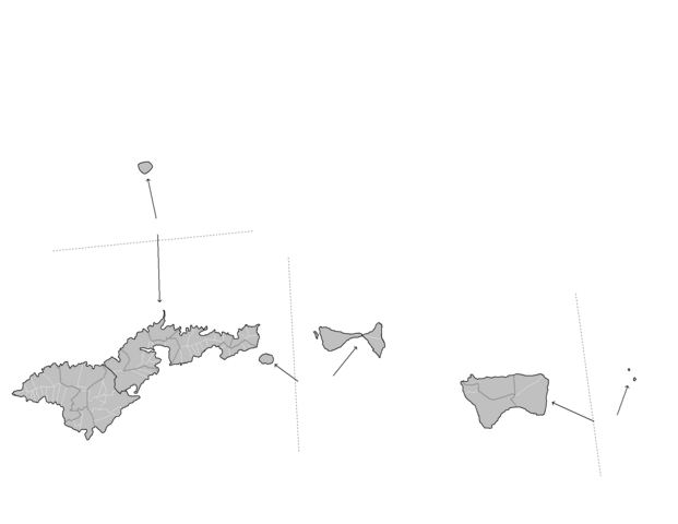
| Description | Map of the administrative divisions of American Samoa. Map is to scale, with distances between the various islands displayed. Created by Rarelibra 17:29, 11 January 2008 (UTC) for public domain use, using MapInfo Professional v8.5 and various mapping resources. |
| Date | 11 January 2008 (original upload date) |
| Source | No machine-readable source provided. Own work assumed (based on copyright claims). |
| Author | No machine-readable author provided. Rarelibra assumed (based on copyright claims). |
Licensing[edit]
| I, the copyright holder of this work, release this work into the public domain. This applies worldwide. In some countries this may not be legally possible; if so: I grant anyone the right to use this work for any purpose, without any conditions, unless such conditions are required by law. |
File history
Click on a date/time to view the file as it appeared at that time.
| Date/Time | Thumbnail | Dimensions | User | Comment | |
|---|---|---|---|---|---|
| current | 15:51, 4 December 2010 | | 2,112 × 1,632 (44 KB) | Beao (talk | contribs) | Transparent. |
| 17:29, 11 January 2008 |  | 2,112 × 1,632 (37 KB) | Rarelibra (talk | contribs) | Map of the administrative divisions of American Samoa. Map is to scale, with distances between the various islands displayed. Created by ~~~~ for public domain use, using MapInfo Professional v8.5 and various mapping resources. |
You cannot overwrite this file.
File usage on Commons
The following 2 pages use this file:
- Atlas of American Samoa
- File:American Samoa admin.png (file redirect)
File usage on other wikis
The following other wikis use this file:
- Usage on fy.wikipedia.org
- Usage on ja.wikipedia.org
- Usage on mt.wikipedia.org
- Usage on nl.wikipedia.org