File:Map Aliki peninsula-fr.svg

Original file (SVG file, nominally 352 × 555 pixels, file size: 197 KB)
Captions
Captions
Summary[edit]
| Description |
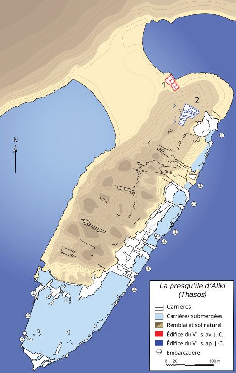
Català: Mapa de la península d'Alikí (illa de Tasos, Grècia).
Llegenda:
Français : Carte de la péninsule d'Aliki (île de Thasos, Grèce).
Légende :
|
||||||||
| Date | |||||||||
| Source | Dessin personnel réalisé avec Adobe Illustrator (données reprises de T. Koželj, J.-P. Sodini et A. Lambraki, Aliki, t. I : « Les Carrières de marbre à l’époque paléochrétienne », Études thasiennes IX, Athènes, 1980). | ||||||||
| Author | Marsyas | ||||||||
| Permission (Reusing this file) |
I, the copyright holder of this work, hereby publish it under the following licenses:
This file is licensed under the Creative Commons Attribution-Share Alike 2.5 Generic license.
You may select the license of your choice. |
||||||||
| Other versions |
File:Map Aliki peninsula-fr.svg has 2 translations.
|


|
This SVG file contains embedded text that can be translated into your language, using any capable SVG editor, text editor or the SVG Translate tool. For more information see: About translating SVG files. |
This file is translated using SVG <switch> elements. All translations are stored in the same file! Learn more.
For most Wikipedia projects, you can embed the file normally (without a To translate the text into your language, you can use the SVG Translate tool. Alternatively, you can download the file to your computer, add your translations using whatever software you're familiar with, and re-upload it with the same name. You will find help in Graphics Lab if you're not sure how to do this. |
File history
Click on a date/time to view the file as it appeared at that time.
| Date/Time | Thumbnail | Dimensions | User | Comment | |
|---|---|---|---|---|---|
| current | 15:00, 5 February 2024 | | 352 × 555 (197 KB) | Manlleus (talk | contribs) | File uploaded using svgtranslate tool (https://svgtranslate.toolforge.org/). Added translation for ca. |
| 22:34, 11 January 2007 |  | 352 × 555 (199 KB) | Bibi Saint-Pol (talk | contribs) | rotation cadre | |
| 22:31, 11 January 2007 |  | 352 × 555 (199 KB) | Bibi Saint-Pol (talk | contribs) | déplacement légende | |
| 22:23, 11 January 2007 |  | 352 × 555 (198 KB) | Bibi Saint-Pol (talk | contribs) | élargissement | |
| 22:19, 11 January 2007 |  | 349 × 555 (197 KB) | Bibi Saint-Pol (talk | contribs) | == Description == {{Information |Description= {{fr|Carte de la péninsule d'Aliki (île de Thasos, Grèce).}} |Source=Dessin personnel réalisé avec Adobe Illustrator (données reprises de T. Koželj, J.-P. Sodini et A. Lambraki, ''Aliki'', t. I : � |
You cannot overwrite this file.
File usage on Commons
The following 3 pages use this file:
File usage on other wikis
The following other wikis use this file:
- Usage on ca.wikipedia.org
- Usage on es.wikipedia.org
- Usage on fr.wikipedia.org