File:Map, Ahrenshagen-Daskow (LRM 20200517 163621-hdr).jpg
Jump to navigation
Jump to search
Size of this preview: 519 × 599 pixels. Other resolutions: 208 × 240 pixels | 416 × 480 pixels | 665 × 768 pixels | 887 × 1,024 pixels | 1,774 × 2,048 pixels | 2,984 × 3,444 pixels.
Original file (2,984 × 3,444 pixels, file size: 7.86 MB, MIME type: image/jpeg)
Captions
Captions
Add a one-line explanation of what this file represents
Summary[edit]
.jpg&action=edit§ion=1)
| Description |
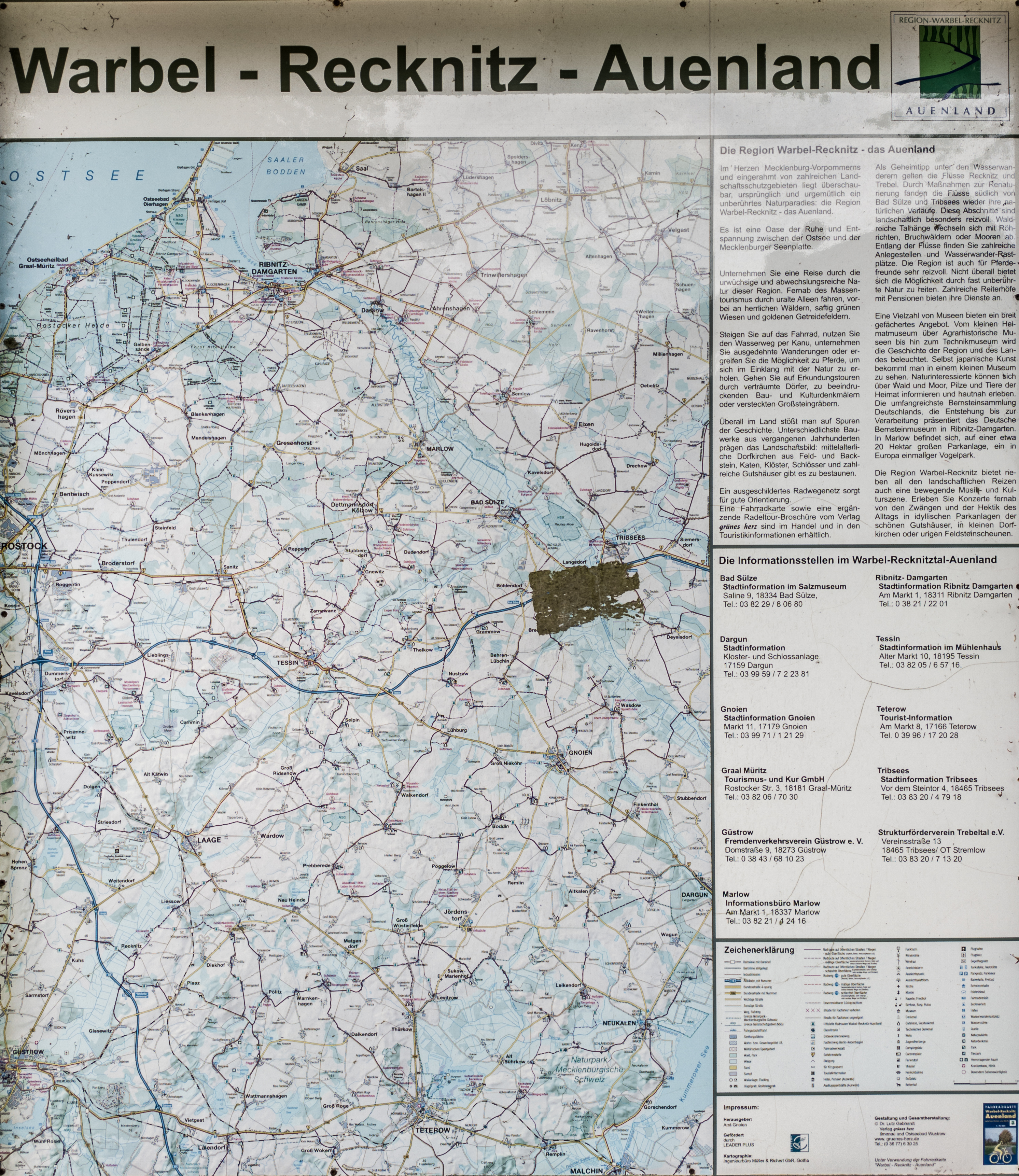
English: Map of Warbel-Recknitz-Auenland |
| Date | |
| Source | Own work |
| Author | Matti Blume |
| Camera location | | View this and other nearby images on: OpenStreetMap |
|---|
.jpg¶ms=054.233807_N_0012.530364_E_globe:Earth_type:camera__&language=en)
|
The photographical reproduction of this work is covered under the article § 59 of the German copyright law, which states that "It shall be permissible to reproduce, by painting, drawing, photography or cinematography, works which are permanently located on public ways, streets or places and to distribute and publicly communicate such copies. For works of architecture, this provision shall be applicable only to the external appearance."
As with all other “limits of copyright by legally permitted uses”, no changes to the actual work are permitted under § 62 of the German copyright law (UrhG). See Commons:Copyright rules by territory/Germany#Freedom of panorama for more information.
|
| Supported by Wikimedia Deutschland: Adobe Lightroom |
|---|
Die Bearbeitung und Verwaltung dieser Datei wurde von Wikimedia Deutschland durch ein Software-Stipendium für Adobe Photoshop Lightroom unterstützt.
|
Licensing[edit]
.jpg&action=edit§ion=2)
I, the copyright holder of this work, hereby publish it under the following licenses:
This file is licensed under the Creative Commons Attribution ShareAlike license, versions 2.0, 2.5, 3.0, 4.0 and any later version released by Creative Commons. You may select the version of your choice. In short: you are free to share and make derivative works of the file under the conditions that you appropriately attribute it, and that you distribute it only under a license identical to this one. Official license: 2.0, 2.5, 3.0, 4.0
|

|
Permission is granted to copy, distribute and/or modify this document under the terms of the GNU Free Documentation License, Version 1.2 or any later version published by the Free Software Foundation; with no Invariant Sections, no Front-Cover Texts, and no Back-Cover Texts. A copy of the license is included in the section entitled GNU Free Documentation License. |
You may select the license of your choice.
File history
Click on a date/time to view the file as it appeared at that time.
| Date/Time | Thumbnail | Dimensions | User | Comment | |
|---|---|---|---|---|---|
| current | 21:56, 26 May 2020 | | 2,984 × 3,444 (7.86 MB) | MB-one (talk | contribs) | Uploaded with LrMediaWiki 0.8.0, LR 9.2.1 Win |
You cannot overwrite this file.
File usage on Commons
The following page uses this file:
.jpg&oldid=750744700)