File:Mammoth Creek, Dixie Mountains, UT 9-09 (12347495124).jpg
Jump to navigation
Jump to search

Size of this preview: 694 × 600 pixels. Other resolutions: 278 × 240 pixels | 556 × 480 pixels | 889 × 768 pixels | 1,185 × 1,024 pixels | 1,750 × 1,512 pixels.
Original file (1,750 × 1,512 pixels, file size: 923 KB, MIME type: image/jpeg)
Captions
Captions
Add a one-line explanation of what this file represents
Summary[edit]
.jpg&action=edit§ion=1)
| Description |
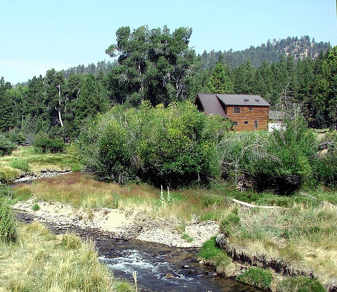
English: (1 in a multiple picture set) The drive along Utah Hwy 143 between Cedar Breaks National Monument and Panquitch, UT, is really varied and beautiful. You'll see scenes like this one, along with lava fields, lakes, and ranches. Wish that cabin belonged to me! |
| Date | Taken on 31 August 2009, 09:42:51 |
| Source | https://www.flickr.com/photos/23155134@N06/12347495124/ |
| Author | inkknife_2000 (7.5 million views +) |
| Permission (Reusing this file) |
At the time of upload, the image license was automatically confirmed using the Flickr API. For more information see Flickr API detail. |
| Flickr sets |
|
| Flickr pools |
|
| Flickr tags |
|
| Camera location | | View this and other nearby images on: OpenStreetMap |
|---|
.jpg¶ms=037.665885_N_-112.664108_E_globe:Earth_type:camera__&language=en)
Licensing[edit]
.jpg&action=edit§ion=2)
This file is licensed under the Creative Commons Attribution-Share Alike 2.0 Generic license.
- You are free:
- to share – to copy, distribute and transmit the work
- to remix – to adapt the work
- Under the following conditions:
- attribution – You must give appropriate credit, provide a link to the license, and indicate if changes were made. You may do so in any reasonable manner, but not in any way that suggests the licensor endorses you or your use.
- share alike – If you remix, transform, or build upon the material, you must distribute your contributions under the same or compatible license as the original.
| This image was originally posted to Flickr by inkknife_2000 (7.5 million views +) at https://flickr.com/photos/23155134@N06/12347495124. It was reviewed on 27 March 2017 by FlickreviewR and was confirmed to be licensed under the terms of the cc-by-sa-2.0. |
File history
Click on a date/time to view the file as it appeared at that time.
| Date/Time | Thumbnail | Dimensions | User | Comment | |
|---|---|---|---|---|---|
| current | 12:06, 27 March 2017 | | 1,750 × 1,512 (923 KB) | Fæ (talk | contribs) | Don Graham, Set 72157643965896364, ID 12347495124, Original title Mammoth Creek, Dixie Mountains, UT 9-09 |
You cannot overwrite this file.
File usage on Commons
There are no pages that use this file.
.jpg&oldid=809394709)