File:Malerreka eskualde OSM 2021-11.png
Jump to navigation
Jump to search

Size of this preview: 800 × 520 pixels. Other resolutions: 320 × 208 pixels | 640 × 416 pixels | 1,024 × 665 pixels | 1,487 × 966 pixels.
Original file (1,487 × 966 pixels, file size: 991 KB, MIME type: image/png)
Captions
Captions
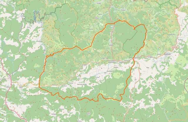
Perimeter of the comarca of Malerreka / Alto Bidasoa
Summary[edit]
| Description |
Euskara: Malerreka eskualdearen ingurua, Navarra https://www.openstreetmap.org/relation/13469520#map=12/43.1288/-1.7101 Español: Perimetro de la comarca navarra de Alto Bidasoa / Malerreka
https://www.openstreetmap.org/relation/13469520#map=12/43.1288/-1.7101 Français : Périmètre de la comarque espagnole de Malerreka / Alto Bidasoa en Navarre
https://www.openstreetmap.org/relation/13469520#map=12/43.1288/-1.7101 English: Perimeter of the spanish comarca of Malerreka / Alto Bidasoa, Navarre https://www.openstreetmap.org/relation/13469520#map=12/43.1288/-1.7101 |
| Date | |
| Source |
Screenshot of OpenStreetMap at scale 12, around GPS position 43.1288 N, -1.7101 W https://www.openstreetmap.org/relation/13469520#map=12/43.1288/-1.7101 |
| Author | OpenStreetMap contributors |
Licensing[edit]
| This work contains information from OpenStreetMap, which is made available under the Open Database License (ODbL).
The ODbL does not require any particular license for maps produced from ODbL data. Prior to 1 August 2020, map tiles produced by the OpenStreetMap Foundation were licensed under the CC-BY-SA-2.0 license. Maps produced by other people may be subject to other licences. |
File history
Click on a date/time to view the file as it appeared at that time.
| Date/Time | Thumbnail | Dimensions | User | Comment | |
|---|---|---|---|---|---|
| current | 10:25, 1 December 2021 | | 1,487 × 966 (991 KB) | BotaFlo (talk | contribs) | Uploaded a work by OpenStreetMap contributors from Screenshot of OpenStreetMap at scale 12, around GPS position 43.1288 N, -1.7101 W https://www.openstreetmap.org/relation/13469520#map=12/43.1288/-1.7101 with UploadWizard |
You cannot overwrite this file.
File usage on Commons
The following page uses this file:
File usage on other wikis
The following other wikis use this file:
- Usage on es.wikipedia.org
- Usage on eu.wikipedia.org
- Usage on fr.wikipedia.org