File:Malawi location map Topographic.png
Jump to navigation
Jump to search
Size of this preview: 293 × 599 pixels. Other resolutions: 117 × 240 pixels | 235 × 480 pixels | 749 × 1,531 pixels.
Original file (749 × 1,531 pixels, file size: 2.07 MB, MIME type: image/png)
Captions
Captions
Add a one-line explanation of what this file represents
Summary[edit]
| Description |
Deutsch: Positionskarte von Malawi
Quadratische Plattkarte. Geographische Begrenzung der Karte:
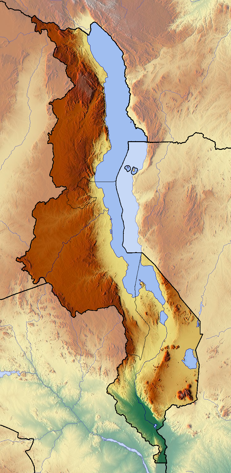
English: Location map of Malawi
Equirectangular projection. Geographic limits of the map:
|
| Date | |
| Source | Own work (backgroung : http://www.maps-for-free.com) |
| Author | Dr Brains |
Licensing[edit]
I, the copyright holder of this work, hereby publish it under the following licenses:

|
Permission is granted to copy, distribute and/or modify this document under the terms of the GNU Free Documentation License, Version 1.2 only as published by the Free Software Foundation; with no Invariant Sections, no Front-Cover Texts, and no Back-Cover Texts. A copy of the license is included in the section entitled GNU Free Documentation License. | 1.2 only |
|
|
Permission is granted to copy, distribute and/or modify this document under the terms of the GNU Free Documentation License, Version 1.3 or any later version published by the Free Software Foundation; with no Invariant Sections, no Front-Cover Texts, and no Back-Cover Texts. A copy of the license is included in the section entitled GNU Free Documentation License.
|
If this file is eligible for relicensing, it may also be used under the Creative Commons Attribution-ShareAlike 3.0 license. The relicensing status of this image needs to be manually reviewed by an experienced user. You can help.
|
You may select the license of your choice.
File history
Click on a date/time to view the file as it appeared at that time.
| Date/Time | Thumbnail | Dimensions | User | Comment | |
|---|---|---|---|---|---|
| current | 18:40, 11 June 2012 | | 749 × 1,531 (2.07 MB) | Dr Brains (talk | contribs) |
You cannot overwrite this file.
File usage on Commons
The following 2 pages use this file:
File usage on other wikis
The following other wikis use this file:
- Usage on ar.wikipedia.org
- Usage on bs.wikipedia.org
- Usage on ceb.wikipedia.org
- Usage on ce.wikipedia.org
- Usage on cs.wikipedia.org
- Usage on dsb.wikipedia.org
- Usage on en.wikipedia.org
- Usage on eo.wikipedia.org
- Usage on gl.wikipedia.org
- Usage on hsb.wikipedia.org
- Usage on ja.wikipedia.org
- Usage on kaa.wikipedia.org
- Usage on ko.wikipedia.org
- Usage on mk.wikipedia.org
- Usage on ml.wikipedia.org
- Usage on no.wikipedia.org
- Usage on sco.wikipedia.org
- Usage on simple.wikipedia.org
- Usage on si.wikipedia.org
- Usage on sl.wikipedia.org
- Usage on sq.wikipedia.org
- Usage on tg.wikipedia.org
- Usage on th.wikipedia.org
- Usage on tum.wikipedia.org
- Usage on uk.wikipedia.org
- Usage on uz.wikipedia.org
- Usage on vec.wikipedia.org
- Usage on war.wikipedia.org