File:Macau topographic blank map.png
Jump to navigation
Jump to search

Size of this preview: 511 × 599 pixels. Other resolutions: 205 × 240 pixels | 409 × 480 pixels | 694 × 814 pixels.
Original file (694 × 814 pixels, file size: 178 KB, MIME type: image/png)
Captions
Captions
Add a one-line explanation of what this file represents
| Description |
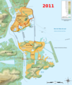
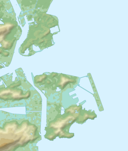
Français : Carte topographique de Macao. Les côtes et la topographie changent considérablement chaque année : les polders les plus récents n'apparaissent pas. Le tracé des côtes est essentiellement issue d'images satellite de Landsat 7 (2000) et corrigé d'après la carte d'Openstreetmap (2004) et File:Macau-CIA WFB Map.png. Deutsch: Topographische Karte zum Macao English: Topographic map of Macau Español: Mapa topográfico de Macao Italiano: Carta topografica de Macao 日本語: マカオの地形地図 Português: Carta topográfica do Macau |
||||
| Date | 05/09/2010 (9 mai 2010) | ||||
| Source |
Français : Création personnelle ;
English: Own work ;
|
||||
| Author | Bourrichon - fr:Bourrichon | ||||
| Permission (Reusing this file) |
I, the copyright holder of this work, hereby publish it under the following licenses:
This file is licensed under the Creative Commons Attribution-Share Alike 3.0 Unported, 2.5 Generic, 2.0 Generic and 1.0 Generic license.
You may select the license of your choice. |
||||
| Other versions |
[]
|


File history
Click on a date/time to view the file as it appeared at that time.
| Date/Time | Thumbnail | Dimensions | User | Comment | |
|---|---|---|---|---|---|
| current | 15:53, 10 May 2010 | | 694 × 814 (178 KB) | Bourrichon (talk | contribs) | {{Information |Description= {{fr|Carte topographique en français de Macao. Les côtes et la topographie changent considérablement chaque année : les polders les plus récents n'apparaissent pas. Le tracé des côtes est ess |
You cannot overwrite this file.
File usage on Commons
The following 61 pages use this file:
- 澳門
- File:Macau administrative blank map.png
- File:Macau administrative map-fr.svg
- File:Macau topographic blank map.png
- File:Macau topographic map-fr.svg
- File:Macau topographic map-fr animated.gif
- File:Macau topographic map-fr animated.xcf
- Template:Other versions/Macau map
- Category:1889 in Macau
- Category:1906 in Macau
- Category:1937 in Macau
- Category:1939 in Macau
- Category:1978 in Macau
- Category:1981 in Macau
- Category:2021 in Macau
- Category:Airports in Macau
- Category:Association football players from Macau
- Category:Badminton in Macau
- Category:Badminton players from Macau
- Category:Beaches of Macau
- Category:Births in Macau
- Category:Bodies of water in Macau
- Category:Books about Macau
- Category:Border crossings of Macau
- Category:Bridges in Macau
- Category:Buddhist temples in Macau
- Category:Cemeteries in Macau
- Category:Churches in Macau
- Category:Companies of Macau
- Category:Environment of Macau
- Category:Events in Macau
- Category:Festivals of Macau
- Category:Guanyin temples in Macau
- Category:Hospitals in Macau
- Category:Lighthouses in Macau
- Category:Macau
- Category:Macau by decade
- Category:Macau in the 1880s
- Category:Macau in the 1900s
- Category:Macau in the 1920s
- Category:Macau in the 1930s
- Category:Macau in the 1950s
- Category:Macau in the 1970s
- Category:Macau in the 1980s
- Category:Macau in the 1990s
- Category:Macau in the 2000s
- Category:Macau in the 2010s
- Category:Macau in the 2020s
- Category:Macau in the 21st century
- Category:Maps of Macau
- Category:Mazu temples in Macau
- Category:Military history of Macau
- Category:Performing arts in Macau
- Category:Piers in Macau
- Category:Power plants in Macau
- Category:Restaurants in Macau
- Category:Society of Macau
- Category:Streets in Macau
- Category:Transport infrastructure in Macau
- Category:Views of Macau
- Category:Water transport in Macau
File usage on other wikis
The following other wikis use this file:
- Usage on fr.wikipedia.org
- Usage on la.wikipedia.org
- Usage on www.wikidata.org