File:Maats Eilat Taba.jpg

Original file (2,395 × 1,817 pixels, file size: 862 KB, MIME type: image/jpeg)
Captions
Captions
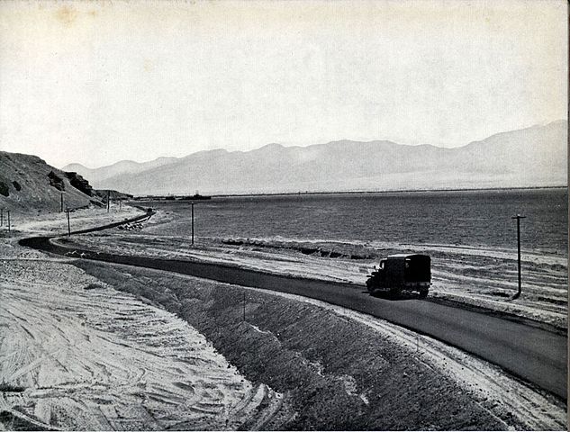
| Description | כביש אילת-טאבה. הכביש הדרומי ביותר בארץ; מקשר את אילת עם נקודת הגבול הישראלית-מצרית, 1958 | |||
| Date | to 1958 | |||
| Source | The Ten-Year Anniversary Book of the Israeli Department of Public Works | |||
| Author | photographers unknown, PD in Israel after 50 years. | |||
| Permission (Reusing this file) |
|

File history
Click on a date/time to view the file as it appeared at that time.
| Date/Time | Thumbnail | Dimensions | User | Comment | |
|---|---|---|---|---|---|
| current | 20:43, 28 March 2010 | | 2,395 × 1,817 (862 KB) | Ijon (talk | contribs) | {{Information |Description=כביש אילת-טאבה. הכביש הדרומי ביותר בארץ; מקשר את אילת עם נקודת הגבול הישראלית-מצרית, 1958 |Source=The Ten-Year Anniversary Book of the Israeli Department of Pub |
You cannot overwrite this file.
File usage on Commons
The following page uses this file: