File:Ludwigshöhe- Rudelsheim- Gedenkstein an Rudelsheim mit Lageplan von Rudelsheim (um 1784) 15.10.2017.jpg
Jump to navigation
Jump to search

Size of this preview: 716 × 599 pixels. Other resolutions: 287 × 240 pixels | 573 × 480 pixels | 918 × 768 pixels | 1,223 × 1,024 pixels | 2,447 × 2,048 pixels | 6,336 × 5,304 pixels.
Original file (6,336 × 5,304 pixels, file size: 39.01 MB, MIME type: image/jpeg)
Captions
Captions
Add a one-line explanation of what this file represents
Summary[edit]
_15.10.2017.jpg&action=edit§ion=1)
| Description |
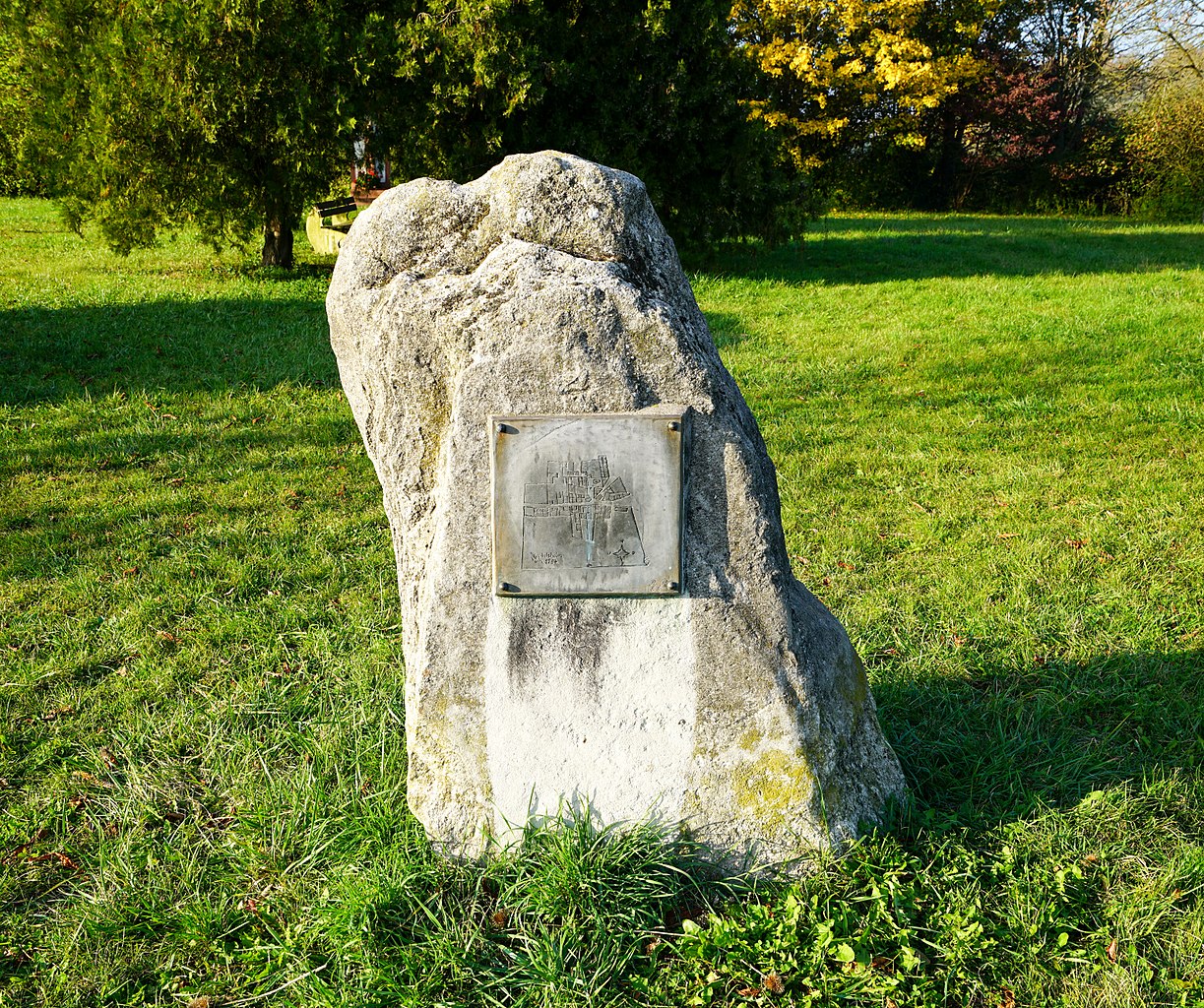
Deutsch: Gedenkstein an Rudelsheim mit einem Lageplan von Rudelsheim, das Rudelsheim um das Jahr 1784 zeigt, auf der ehemaligen Gemarkung der Gemeinde Rudelsheim auf der heutigen (2017) Gemarkung der Ortsgemeinde Ludwigshöhe in Rheinhessen. Am 25. August 1822 erfolgte die Grundsteinlegung von Ludwigshöhe, deren Ortsmitte heute (2017) etwa zwei Kilometer westlich dieses Gedenksteins liegt. |
| Date | |
| Source | Own work |
| Author | Jivee Blau |
| Camera location | | View this and other nearby images on: OpenStreetMap |
|---|
_15.10.2017.jpg¶ms=049.816837_N_0008.372505_E_globe:Earth_type:camera_alt:86.9819_source:exif_&language=en)
Licensing[edit]
_15.10.2017.jpg&action=edit§ion=2)
I, the copyright holder of this work, hereby publish it under the following license:
This file is licensed under the Creative Commons Attribution-Share Alike 4.0 International license.
- You are free:
- to share – to copy, distribute and transmit the work
- to remix – to adapt the work
- Under the following conditions:
- attribution – You must give appropriate credit, provide a link to the license, and indicate if changes were made. You may do so in any reasonable manner, but not in any way that suggests the licensor endorses you or your use.
- share alike – If you remix, transform, or build upon the material, you must distribute your contributions under the same or compatible license as the original.
File history
Click on a date/time to view the file as it appeared at that time.
| Date/Time | Thumbnail | Dimensions | User | Comment | |
|---|---|---|---|---|---|
| current | 01:39, 16 October 2017 | | 6,336 × 5,304 (39.01 MB) | Jivee Blau (talk | contribs) | {{Information |Description ={{de|1=Gedenkstein an Rudelsheim mit einem Lageplan von Rudelsheim, das Rudelsheim um das Jahr 1784 zeigt, auf der ehemaligen Gemarkung der Gemeinde Rudelsheim auf der heutigen (2017) Gemarkung der Ortsgemeinde Ludwigshö... |
You cannot overwrite this file.
File usage on Commons
The following page uses this file:
File usage on other wikis
The following other wikis use this file:
- Usage on de.wikipedia.org
_15.10.2017.jpg&oldid=776352835)